I ventured down to the Music City last weekend. This was a whirlwind tour - 16 hours of driving for about a day and a half actually in the city itself. But since I was driving down in my Mobile Trike Garage, of course I had my trike along.
I kid, but this was done on purpose. Once it was clear that I was, in fact, going to be heading down to Nashville I popped open the TrailLink app to see what riding opportunities would present.
It turns out that there are several trails in the region indicated on TrailLink:

Trails, Trails, Trails…
I am not terribly familiar with the region - I’ve visited the area once before, several years ago, and driven through it once since. Given that, ideally I wanted something relative close to where I would be staying, but I also wanted a trail with some distance and, ideally, one that wasn’t directly in a visually urban area.
Seem like a tall order? It did to me as well, and I was prepared to compromise on one point or another if needs be. As I started looking through the trail options, it seemed like distance might be where the compromise would lie. Many of the trails on the map were 1-3 miles or so in length, with a few coming in at under a mile. In addition, many of the longer ones seemed to be outside of the immediate Nashville area.
Two of them in the area were a little longer - the Shelby Bottoms Greenway and the Stones River Greenway at 6.4 and 10.0 miles respectively. And the word “Greenway” implied that I would not be riding in amongst tall buildings or through industrial sites. And, as I dug into the map itself, preparing to decide between the two options, I found a bonus: They connect to each other.
The trailhead where both trails meet is in Two Rivers Park (presumably the Cumberland and Stones Rivers are the nominal two rivers in this case).

Google map of Two Rivers Park
This is a good spot to begin - ample parking, even on a Saturday morning. Unload and roll down the trail, and choose your course - left for Shelby Bottoms, right for Stones River. I took a left.
My plan was to ride through and essentially do a loop of Shelby Bottoms, then come back and ride along at least a portion of the Stones River trail - at least far enough to cross the Stones river itself and maybe to ride along it a bit.
What I found was… not what I expected. On the map the Shelby Bottoms trail looks like it is essentially an extended city park:

Shelby Bottoms on the Map
And that is what I was expecting. The reality was different. And better.
As you leave Two Rivers Park you enter the Shelby Bottoms trail by passing over a long bridge:

Going for the Bottom
You realize, as you cross the bridge, that this area is referred to as a “bottoms” for a reason. On the bridge you are well above the Cumberland River, and you get quite a view of that…
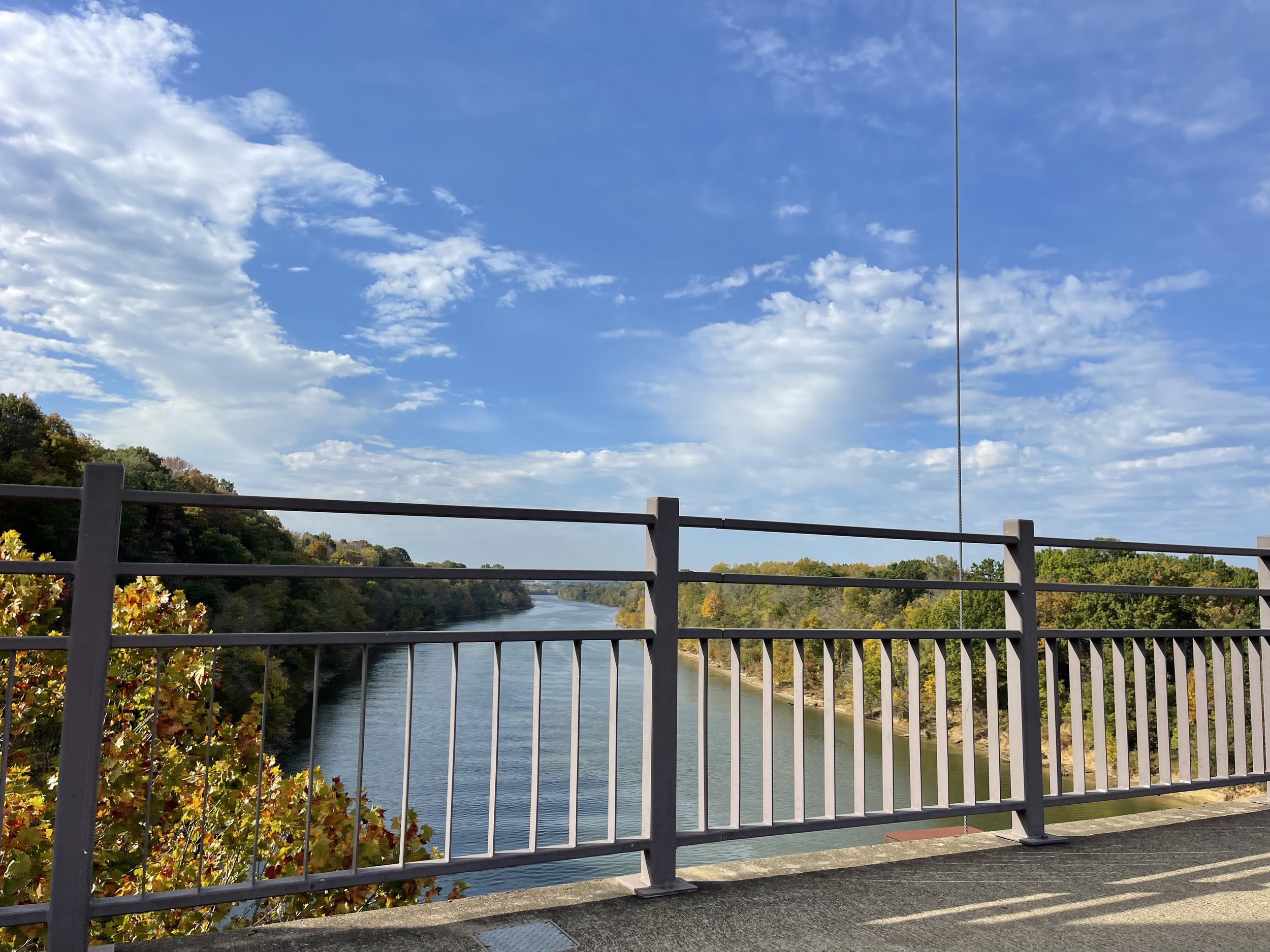
Cumberland River

Cumberland River
…and as a result, you are well above the trail system as well.
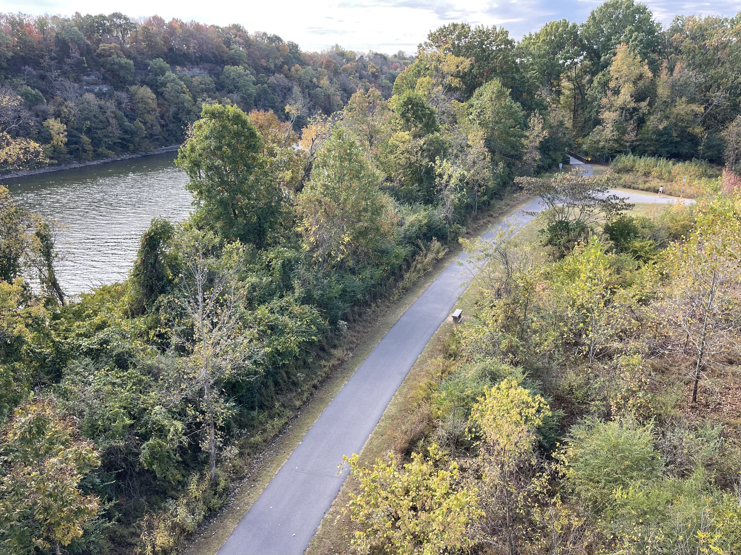
Trail system below
In fact, the trail curves around as it slopes downward to bring you to the Bottoms, and if you look up at the bridge you’ve just crossed, you get a real sense of the scale of things:
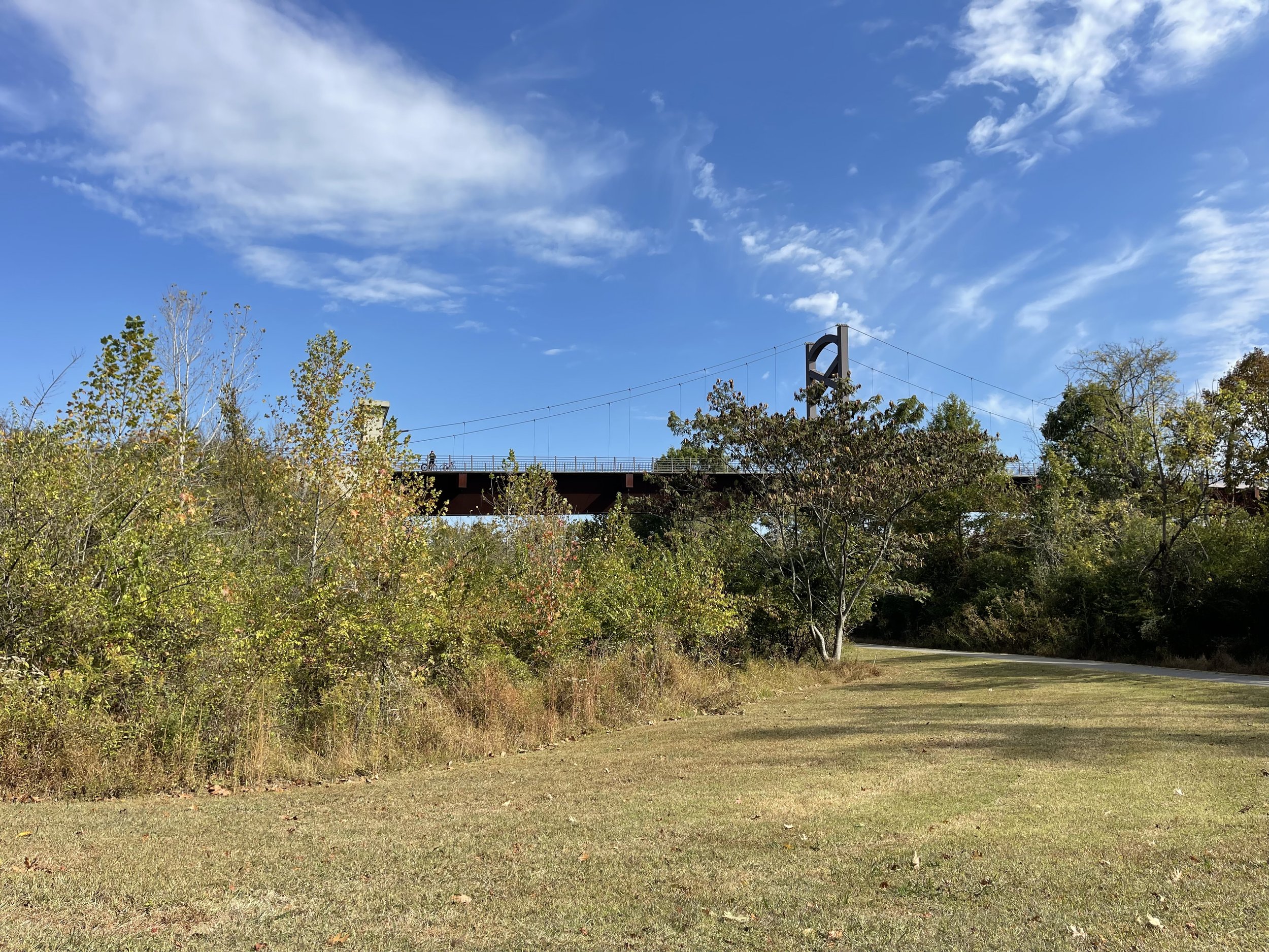
Looking up at the bridge
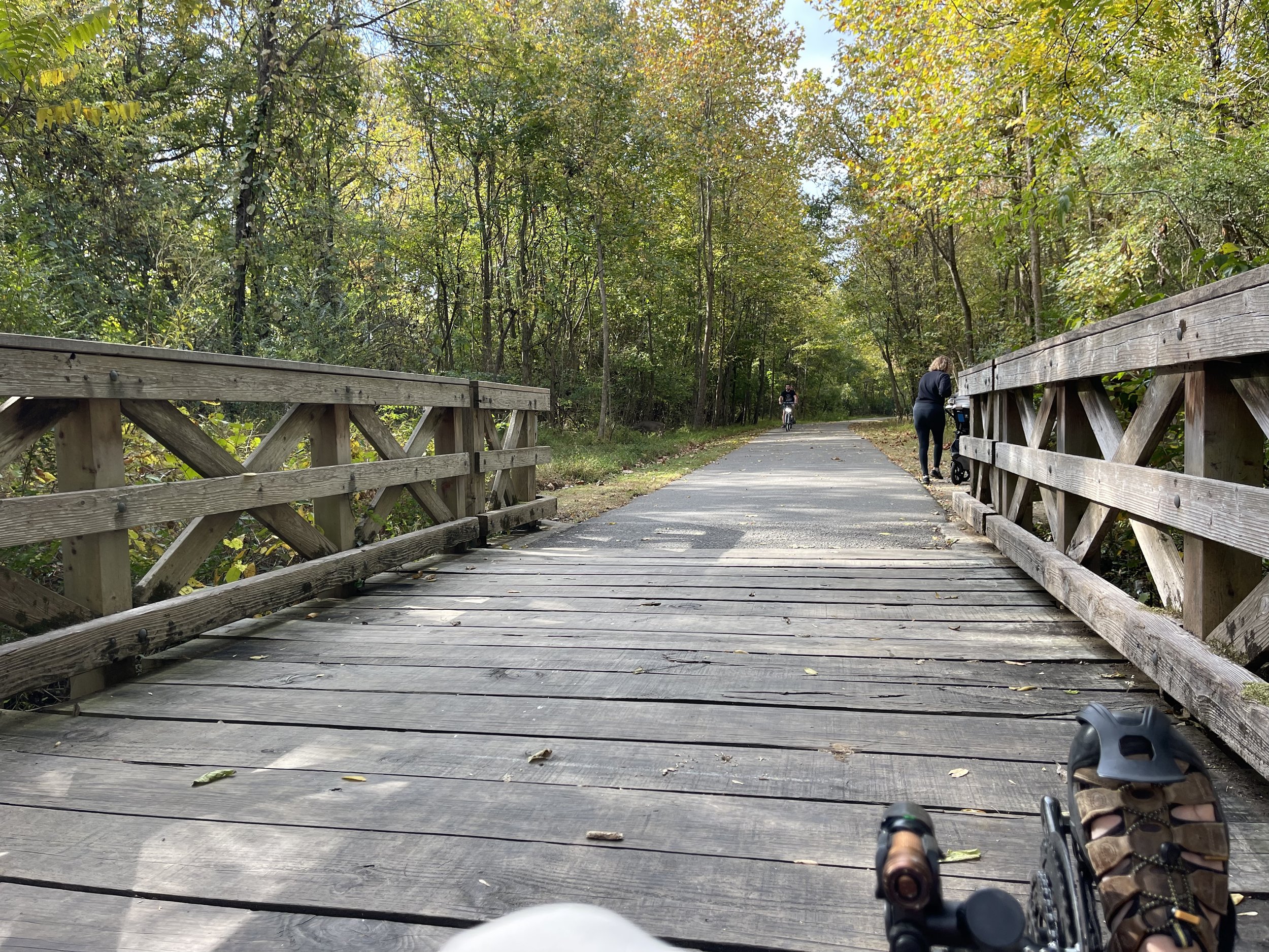
Once I got down below it quickly became clear that this trail was not going to be passing through the standard city park that I was expecting. The terrain this smooth, asphalt trail winds and twists itself through is a real woodland. The trees to either side of the trail are dense enough that you can’t see more than a few dozen feet into them in either direction.

Rolling into the woods

Woods!
Going in, for example, I knew that the Cumberland River was not far to my right, but I could only occasionally catch the briefest glimpse of water between the leaves. And I wasnt the only one who was convinced that I was in the woods:
Oh Deer…

Yes - there really is a deer there.
I snapped this (admittedly poor) picture as I approached the deer. When I got up to where it had been standing, it had run into the trees, and was able to go deeply enough that I could no longer see it.
Enjoying this post? Check out our Cycling page for links to other cycling articles on Applied Life
As you go further into this section of the park, the woods also open up to other environments, including different types of grasslands and wetlands. Some of these are right on the trail…

Open Land & info placard

Trees in wetlands
…and others require that you venture off the beaten path:
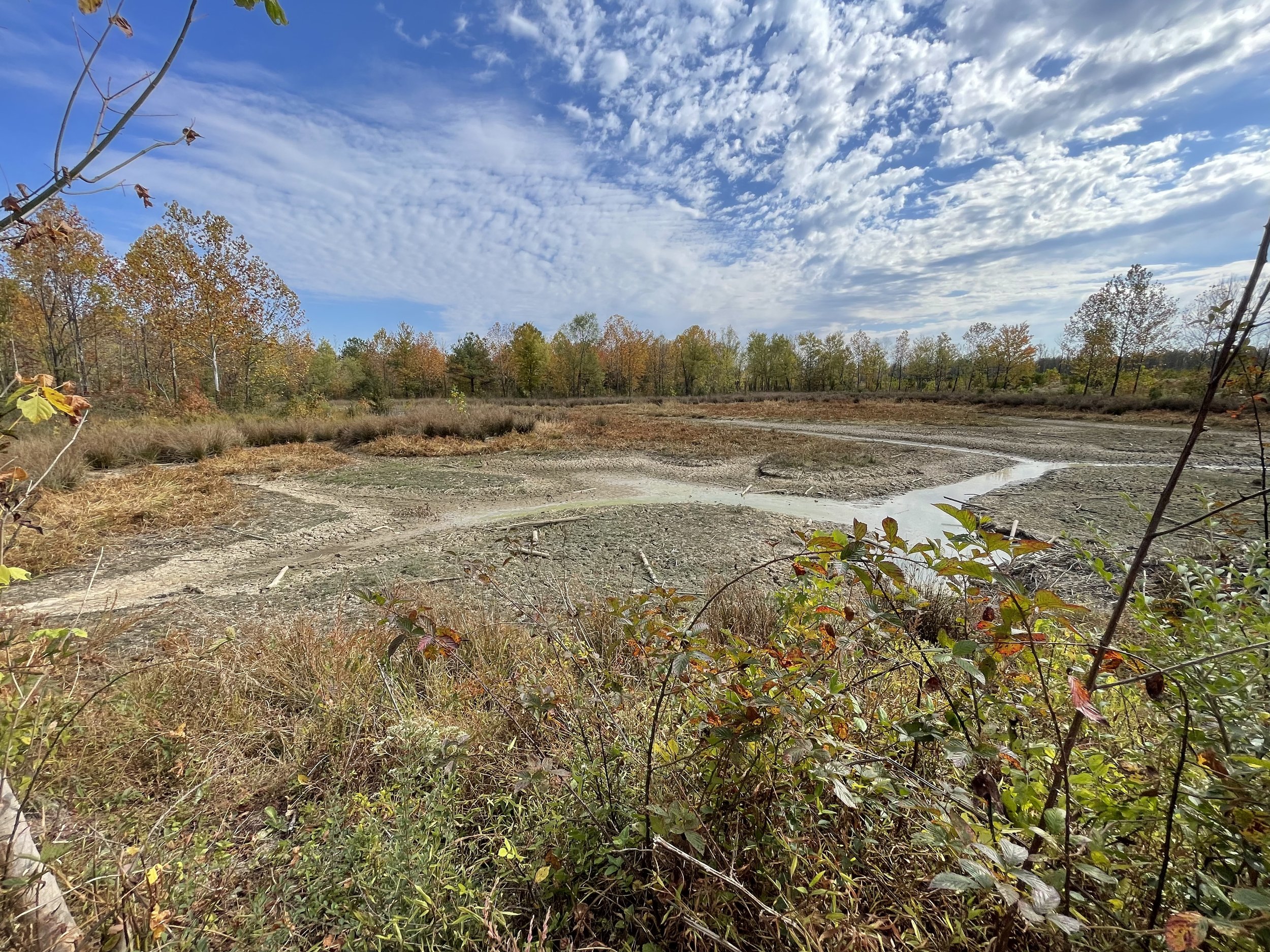
Beaver Territory

Grassland

Grassland
These areas do require that you leave your wheels behind and proceed on foot. I’ll admit here that I didn’t notice the sign that said that until *after* I exited the trail, which I felt a little bad about - I try to respect the guidelines and rules in the places I go. And in retrospect it didn’t surprise me either - on many parts of the trail the tree branches cross the trail so low that they’d take out anyone on an upright machine. On the trike I was comfortably below them, giving a cool tunnel effect that I wasn’t supposed to be enjoying.
After I’d explored essentially the bulk of the trail to the south of the bridge, I returned to it and crossed over to follow the Stones River Greenway. This was also lovely territory, though it actually turned out to be more of what I’d been expecting from the Shelby Bottoms trail, as it ventures past a golf course…

Fore!
…as well as briefly along city streets, soccer fields, and this:

Don’t even *try* to get in here!
Google Maps says that this fence is preventing entrance - and they *really* don’t want you in there, says the razor wire across the top - to the *KR Harrington Water Treatment Plant*. This would not be the first, nor likely the last, trail I’ve ridden that passes a water treatment plant. To their credit, however, I had to ask Google about it because there was nothing about the sight or smell to give away the purpose of the place. This is probably for the best all around, given that it is right next to the soccer fields.
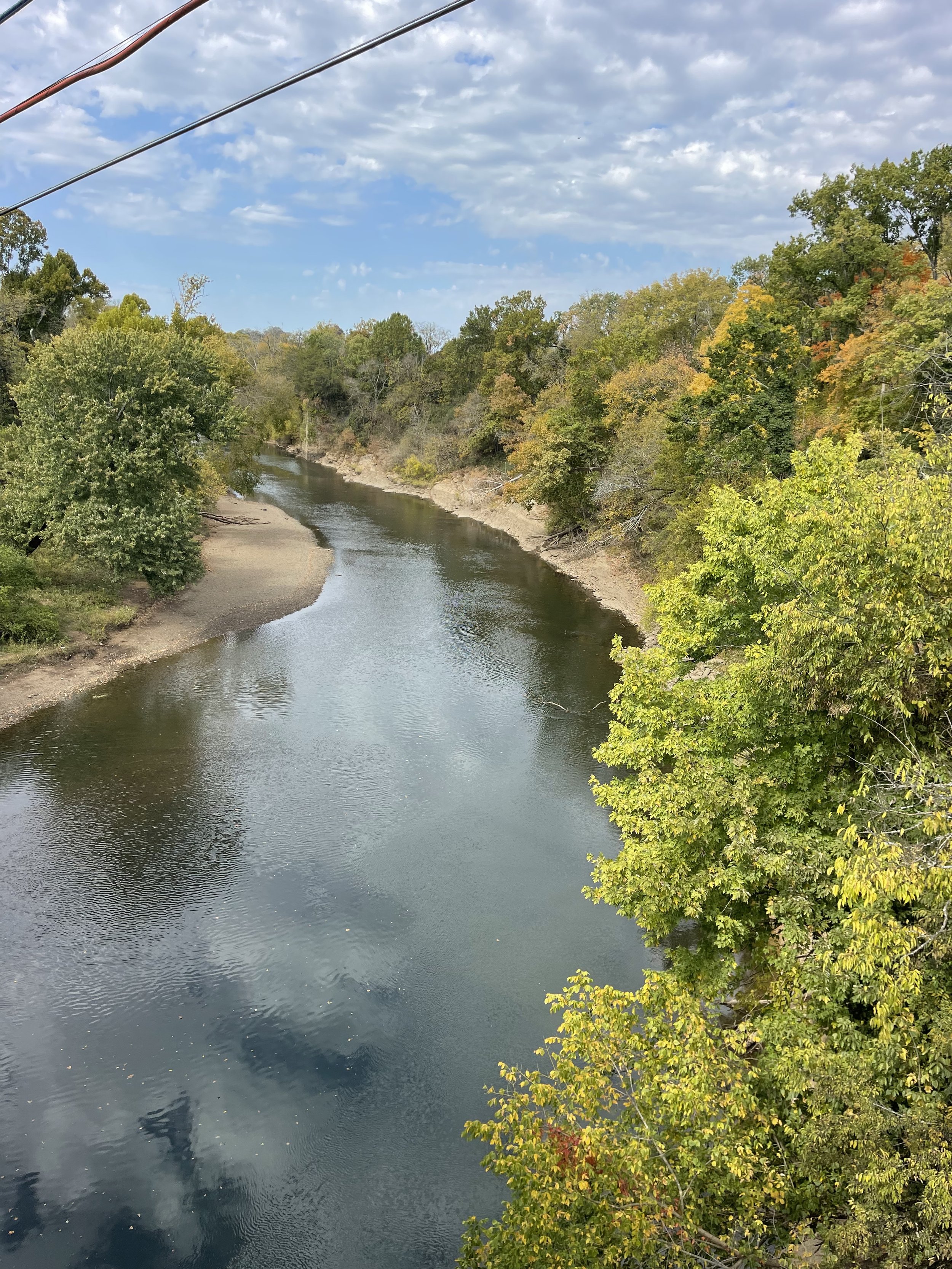
From there, though, it crosses Stones River…
Stones River
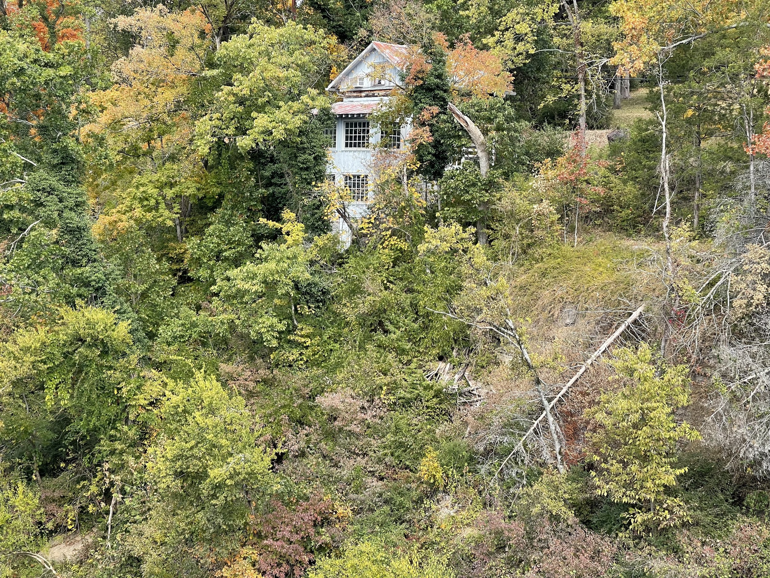
…and things quickly move back into woodland, albeit not as dense as in Shelby Bottoms. A little further along and it opens into what I initially thought was a road - it had a car parked at the end of it - lined by a stone fence. Following it a little ways found me first seeing this cabin:

Eversong Cabin
And then, across from it, this magnificent home:

Historic Stone Hall
The cabin appeared to be a relic, but I couldn’t tell if the home was occupied. It turned out these are both historic sites. Eversong cabin was moved to this location in the 1930’s, and the home is historic Stone Hall.
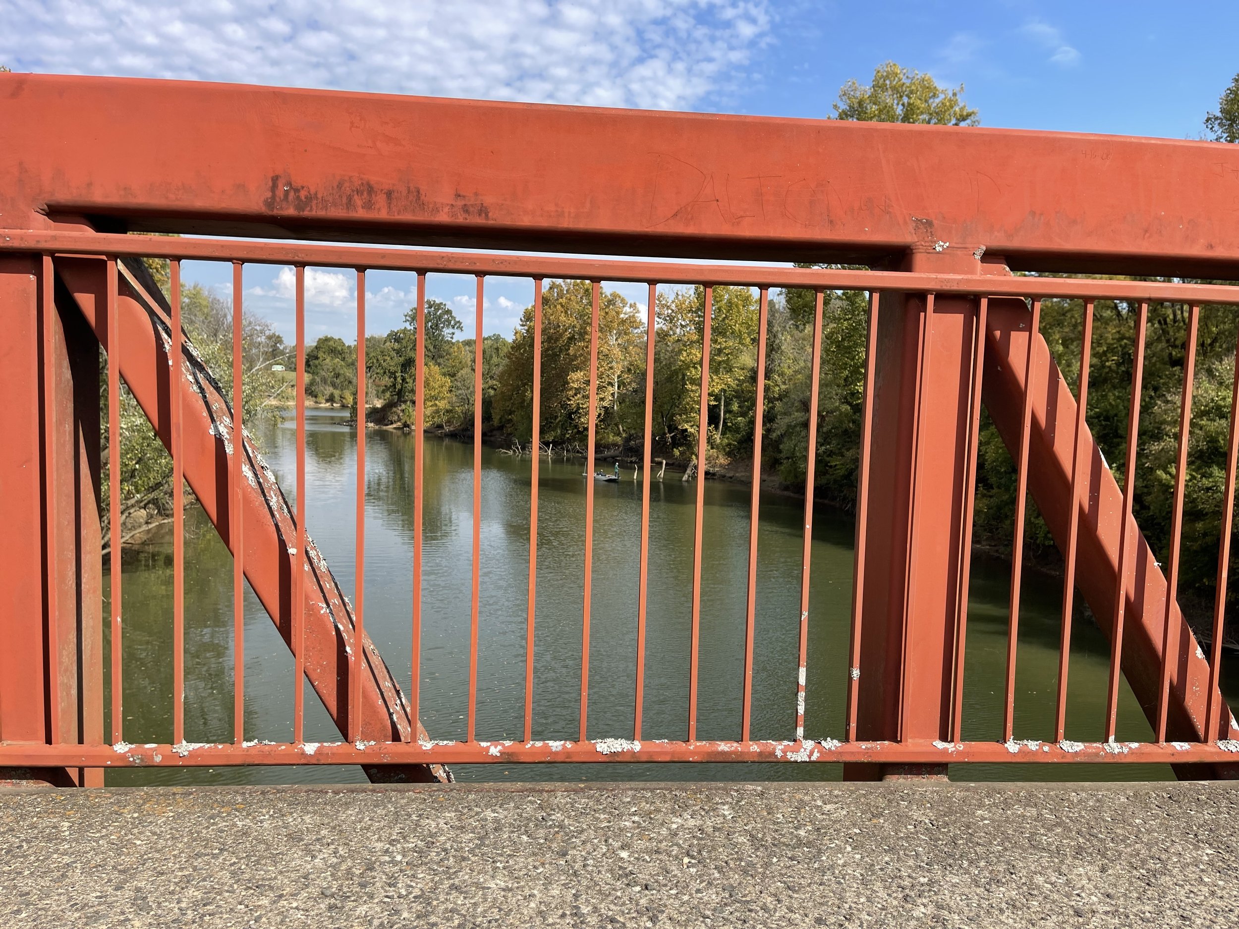
My second crossing of Stones River followed shortly those sights, where the trail again opens out onto a more urban setting along a roadway. Still, I wanted to make that second crossing before turning around, and I did so.

Bob Sheehan Memorial Bridge
I was glad that I did, though, because I got another view of the Stones River…
Ah the Stones, I love the Stones… Fred and Barney…
And probably the best possible view of Eversong Cabin.
Eversong on the Cliff
This ride was a very pleasant surprise, in multiple ways. It was, as I’ve said, not at all what I expected going in, having far more natural engagement than I’d anticipated. Unlike our trails in illinois, there are real elevation changes along it, particularly in and around the Stones River, enough so that I had to drop down to the small front ring (not a common occurrence back home). Most of the trail is in excellent shape, and the scope of the trail system is truly impressive. If I were an information worker who could pick and choose my geographic location, this trail would make me strongly consider relocating to the Nashville area.
I’m clearly not the only one who feels that way. I was on this ride on a Saturday morning, and I had *a lot* of company. This was particularly true on the Shelby Bottoms Greenway, but it was rare in any area to be alone for more than a minute or two.
The volume of usage made me aware of something else that I didn’t necessarily notice right away. Because of the number of people on the trial, my little bike bell got a pretty good workout. But when passing people - even folks with headphones in - I didn’t get nearly the frequency of startled pedestrians that you see back here at home. I realized, after a bit, that this is because these trails are unusually wide. When I would pass, it was with a wide enough berth that I wasn’t really surprising people. Just one more thoughtful bit of the trail’s construction.

Valencia at Stones River Greenway