I took an opportunity recently to explore a trail in a region that those of us here in the Land of Lincoln refer to as being “up north” - in the glaciarized regions of southern Wisconsin.
The Sugar River trail is a rail trail that runs some 22.7 miles from the village of New Glarus southward to the small town of Brodhead.

Sugar River State Trail
If you are from the central Midwest, and enjoy beer outside of the standard fare, the name “New Glarus” may be familiar to you. Among the things the the village is known for is the fact that it is the location for New Glarus Brewing Company, a craft brewery perhaps best known for Spotted Cow, a delightful farmhouse ale that used to be available on both sides of the Illinois/Wisconsin border.
That’s right - used to be available. About twenty years ago the brewery pulled back from Illinois, citing struggles meeting demand for their beers within Wisconsin. This, of course, leaves those of us from south of the border having to engage in Smokey & The Bandit style escapades just to enjoy a cold glass of Spotted Cow.
It’s a bit of a disservice to the village itself that I’m primarily referring to the brewery. It’s a quaint and interesting place in and of itself, being founded in 1845 by settlers from the Canton of Glarus in Switzerland (hence the name)…

New Glarus Historical Sign
…and the downtown itself is focused on that Swiss heritage, with buildings and multiple fairs, festivals, and restaurants related to it. Depending upon where you are at in the town, it’s possible to feel a bit like you are actually in a Swiss village.
But for myself, I was not there for tourism or beer - I was on a different mission, as the downtown also hosts the trailhead for the Sugar River trail. Still - I’d be lying if I didn’t admit that the opportunity to pick up some fresh Spotted Cow from the source didn’t factor in - it would have cut at least a half-hour off my drive time to start in Brodhead instead. And I always enjoyed picturing myself as The Bandit (though - let’s be honest - my Mobile Trike Garage is probably closer to The Snowman’s semi than it is a Trans Am).
The Trail
As I mentioned above, the trail head is situated in downtown New Glarus, between Railroad Street and Route 69. When you first pull on to Railroad Street there is a public parking area along the street, which is small and - on the weekend day I was there - completely full. Head just a little further north, past the old train depot, and you’ll find a larger parking lot that is much more accommodating.

Satellite arial view of the parking situation
That train depot is actually the New Glarus Chamber of Commerce, and handily offers up public restrooms and a drinking fountain. It’s also the place where you can purchase your state trail pass.
What’s a state trail pass, you ask? Well, it’s a pass you purchase so you can - you know - use the trail.
Enjoying this post? Check out our Cycling page for links to other cycling articles on Applied Life
It’s a five dollar fee for a day pass, and $25 for an annual pass. Its required for anyone “16 years of age or older biking, cross country skiing, horseback riding, or inline skating” on Wisconsin State Trails. Hiking and walking is free of charge, as apparently would be the use of quad skates, given the specificity of the description on the state’s website for the fee.
Oh - and there’s a fine if you are caught without a pass. Of course, it’s only $5, so one might choose to take one’s chances. For myself, I figure the fee helps fund the trail, so I’m glad to pay it.
Starting out you ride past the depot, that historical marker (above) describing the origin of the town, and this very stylized map sign:

Big Map Sign
This first part of the trail is asphalt, and rides past a pizza restaurant that appeared to be pretty popular, with lots of bikes parked alongside it. The asphalt is… not in great condition, but fortunately it yields to what the Wisconsin DNR website says is a “crushed stone” surface. And - technically, if you crush stone enough, I supposed it will eventually become dirt, which is what this trail is.

Asphalt Trail - the first mile or so…

“Crushed Stone” - I mean really, really, crushed…
But in either case, it’s mostly in pretty good shape, and in better shape than the asphalt that proceeds it.
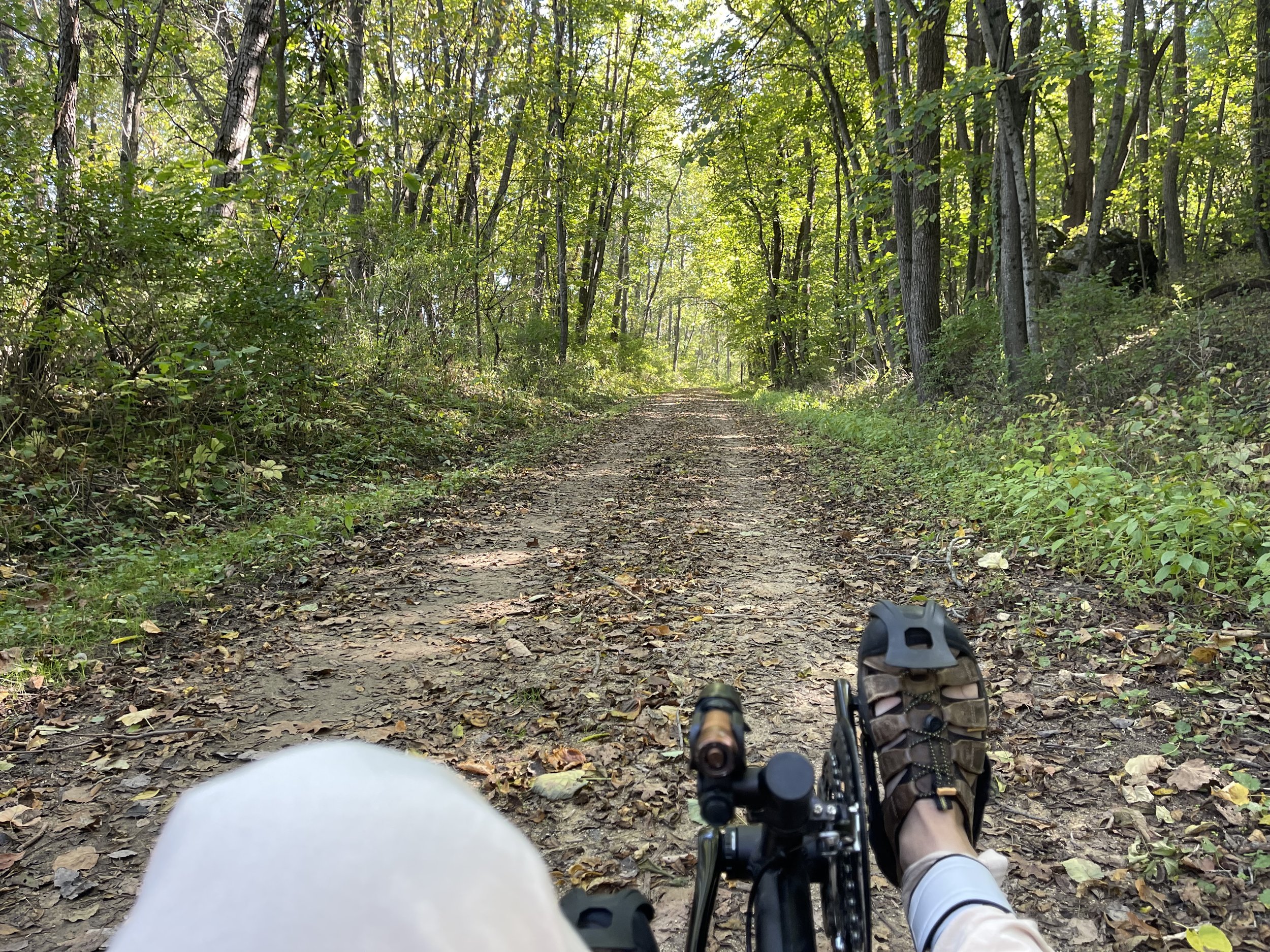
As you get further into it, particularly in the shaded areas (which is most of the trail) it turns into a two-track, with a grassy center.

Two-track with a grassy center
One of the reviewers on the Trail Link app cited this as a reason why it it was not a good trail for recumbent trikes, but I would disagree. Over time I’ve adopted the technique of keeping the rear and right wheel on the track (or just the rear if the track is too narrow), and the left on the grass for trails like this, and I find it works pretty well. The reviewer also suggests that this makes the trail slow going, but I averaged 10.55mph for my 26 mile round trip, which is comparable to, or better than my speeds on other, similar trails such as the Hennepin Canal Trail here in Illinois, or the Military Ridge Trail in southwestern Wisconsin. In general, softer surfaces are slower. That noted, I did come across a handful of small, hidden potholes in the center lane. Those are a little less enjoyable when they occur.
But then, I wasn’t on this trail for speed. I was there to be out in nature, and to enjoy the views.
Out in nature

Not at all sure what that bridge is for - but it was cool to see.
But probably my favorite section in the territory I covered was this one, with an impressive rock wall just to the right side of the trail heading southward:
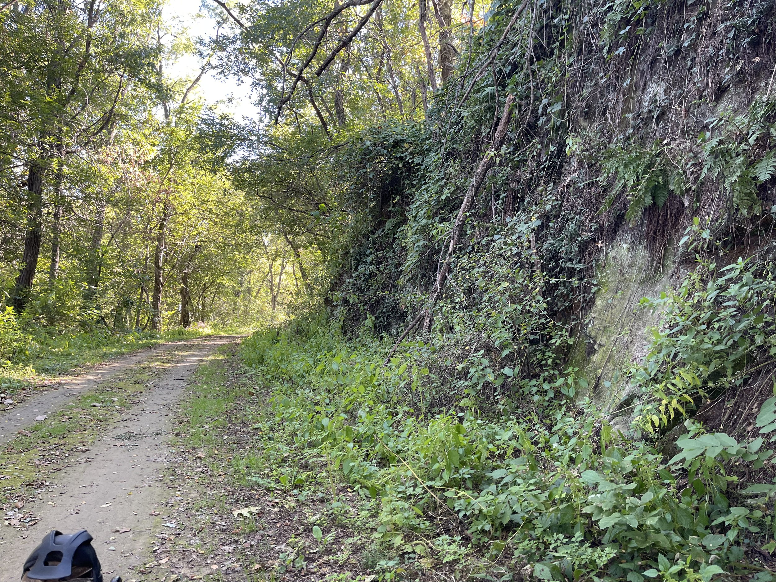
Rock Wall

I was between two… well, several ferns. There were a lot of ferns.
It has an opening or indentation towards the top that, under other circumstances (say, not being in cycling gear) I would have been tempted to climb up to:

Cave?
I also took a panoramic shot of it to get more of the scene into it - it takes everything in, if a little distorted by the effect:

Pano Shot
There are also multiple bridge crossings, water, and marsh views:

Nature!
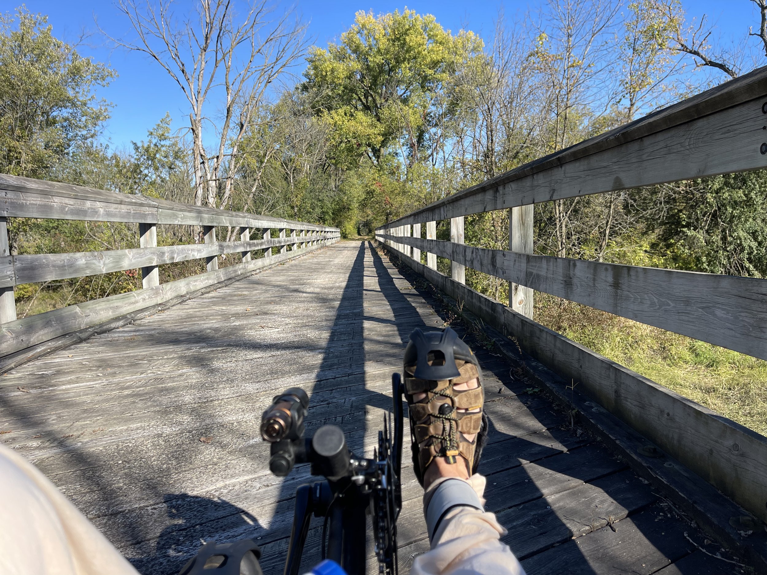
Many Bridges
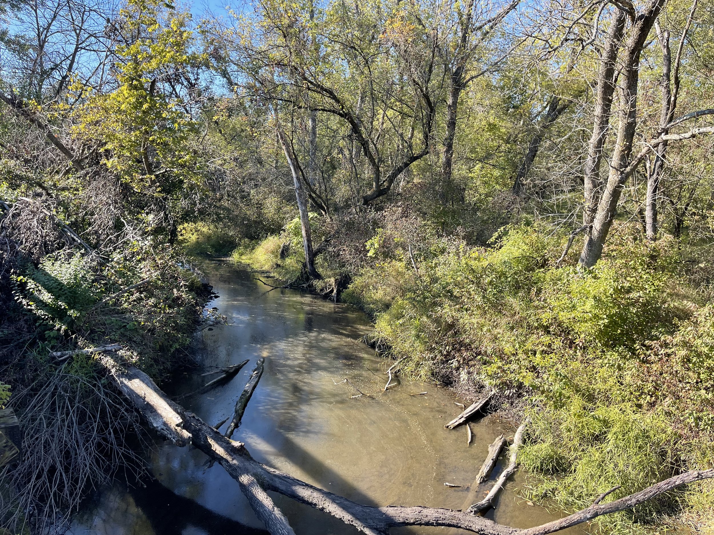
Several water crossings (hence the bridges)
The trail passes through the town of Monticello, which promises food, picnic areas, and an ATM, amount other things.
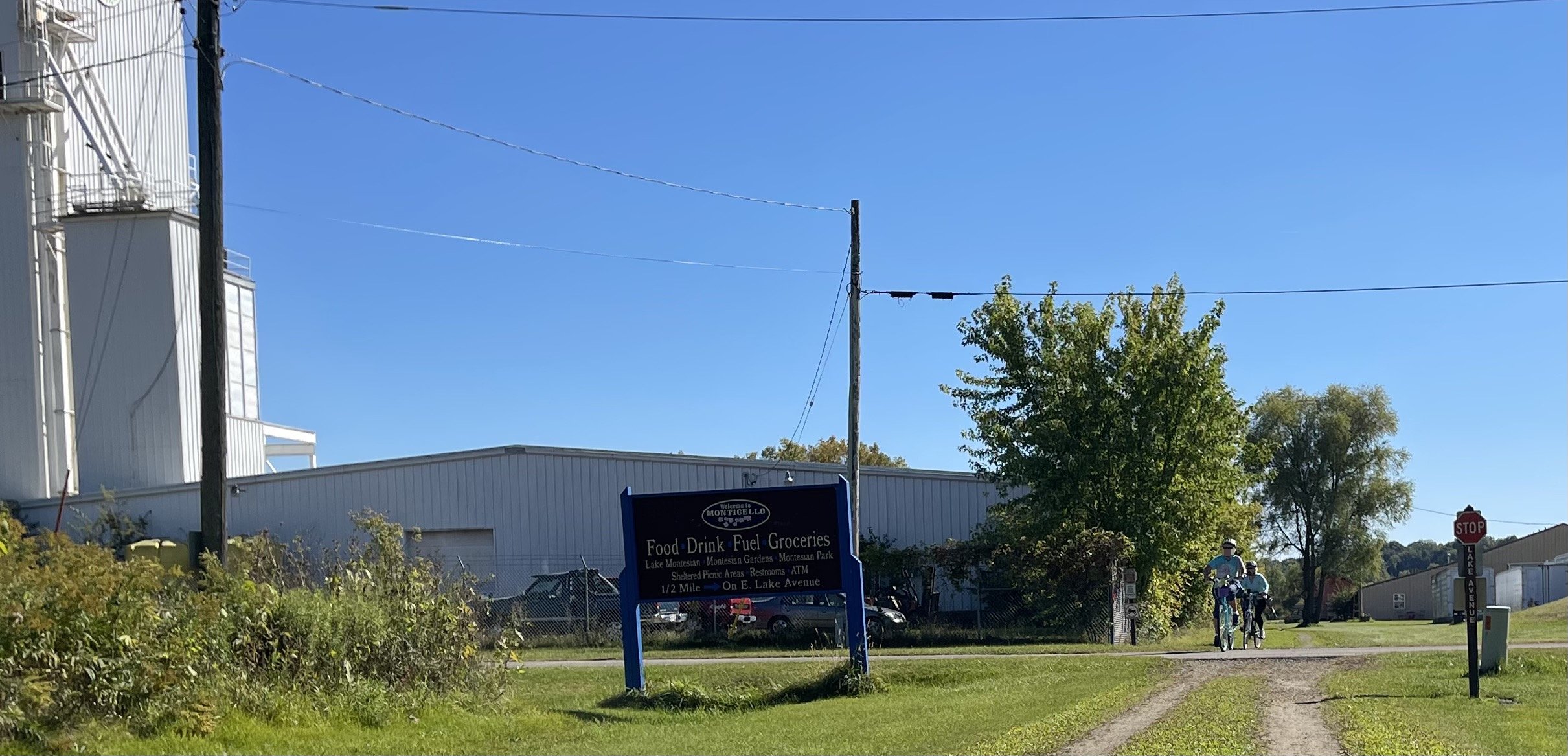
Monticello Sign
I did not stop, but reviews of the trail generally say positive things here. Shortly following that crossing there are public restroom facilities, as well as a drinking fountain:

Restrooms and a urine-replenishment system
This section of the trail also has an intersection with the Badger State Trail, which comes up from the Illinois border, and continues from here northeasterly towards Madison.

Trail Crossing - heading southward
I found this very cool, mostly because, at least outside of the greater Chicago area, Illinois doesn’t really have much by way of trails that intersect one another. Gives one thoughts of the possibilities - if I turned left I could hang out in Madison, right I could head towards home. Of course, with no camping gear along for the ride, I’d have to sleep on the trike…
Speaking of crossings, this trail does cross multiple roads. This is a common component of trails in Wisconsin, in my experience, so it’s par for the course. Some of them have interesting names…

Tin Can Road
…and, aside from Route 69, which you cross after the first mile, the roads were not heavily traveled.
The trail also has mile markers to help mark your progress. They appear to have been posted somewhat… casually - perhaps based on where they’d be easy to insert - as opposed to with an eye towards accuracy. I say this because I found that they matched my GPS petty closely at first, the agreement began to stray further and further - off by almost two-tenths of a mile by marker 12. Not a big deal, but a curious thing to see.
I turned around when I’d reached the 13-mile point, which placed me close to a bridge and over some water in the Albany Wildlife Area. For my purposes this was a manageable distance for the time I’d allotted for the ride, with a 26-mile trip getting me back ahead of nightfall.
This appears to be a popular trail - I came across multiple riders coming from both directions, many - though certainly not all - on mountain bikes with e-assist. There were also a few hikers along the trail. It’s a lovely ride, but it’s not a solitary one.

Me and Valencia on the trail
Oh - and what about the beer?
Would you expect that a brewery with a local store and gift shop in a Swiss-village-style tourism-oriented village would be closed for weekends during Octoberfest?
Neither would I, and we’d both be wrong. I drove back towards Illinois happy about the trail, but sadly without any Wisconsin-only suds to accompany me. Suffice it to say: if you want to ride the trail and go to the brewery, schedule your trip for a weekday and check the hours on their website ahead of time.