The Idea: Recapitulate the original purpose of the Hennepin Canal - connecting the Illinois River to the Mississippi at the Quad Cities - by riding it from its eastern end in Bureau Junction to where it empties into the Rock River at the western end at Timbrook Field in East Moline, and continue on from there to the Mississippi River and across into Iowa. And then, of course, turn around and reverse the trip back to Bureau Junction.
6/24/2022 - Geneseo Campground to canal end at Timbrook Field in East Moline IL - 13 Miles
I woke the morning of day two surprisingly well rested. It’s been years since I’ve actually been camping, so I was a little concerned that I might find that sleeping in a tent was no longer something that worked for my middle-aged body. But the combination of the shower the night before, and liberal application of ibuprofen seems to have done the trick.
I started the day with Biscuits and Gravy by Peak Refuel, paired with a large mug of French Press.

Fueling up for the day
As with the Beef Pasta Marinara I’d had the night before, it was excellent. After years of picking charcoal and grit out of campfire-prepared bacon and eggs, the freeze-dried foods seem like quite a luxury.
The Campground
It just so happened that I had planned my ride over the same weekend that a vintage camper group had reserved space at the campground. I’d been made aware of this when I checked in the night before, but I’d rolled in later than I’d hoped, so my focus was on getting cleaned up and getting my campsite up for the evening. But the morning of the second day I took a look around on my way to and from the bathroom. There were an array of vintage campers - the Aerostreams and similar that you’d expect…

Campers

Campers
…to these massive trailers…

Big old campers
…and a couple of folks really threw themselves into the theme, adding vintage tow vehicles to the mix as well:

Old Trucks

Old Trucks - tho I’m almost old enough myself not to think of that Ford as “old’…
On the Trail
I managed to get everything put together and get out on the trail by about 9:30 in the morning. The entrance to the trail is literally just off the main drive into the campground, which made it very convenient. The trike was a bit lighter for this segment - I left the tent, sleeping bag, and inflatable pad behind at the campsite - and I could feel the difference. This had been part of the plan, since day two was the longest distance of the three. All of which meant things were moving a little faster as I rolled out onto the asphalt of the trail outside the campground.
I knew that I was moving towards a more populated area of the canal trail. It’s not urban, per se - I don’t think you can use that term to apply to any part of the trail. But as you move westward from Geneseo you see houses, side by side, on the opposite side of the canal, and you get less of a sense of isolation.
Which is why I was a little surprised when, a half-hour after leaving the campground, I came across this:

Huh!
You could call it gravel, I suppose - there are stones on the path - but it would be a generous description. But while it was an unexpected surface - and maybe, given the rest of the Canal Trail, it shouldn't have been that surprising - it was a fair trade-off for the view:

Sudden Prairie

Purple Coneflowers

Other purple flowers
The purple coneflowers give the impression that there has been an active effort to put in native prairie plants in this area. It was definitely making the pollinators happy, but for some reason I wasn’t able to convince any of them to stay still long enough to pose for a portrait.
A few miles after the prairie plot, however, the “gravel” gives way to relatively well maintained asphalt. And, in fact, from that point westward, solid surfaces are the rule - either asphalt or concrete, depending upon where you are at.
As this starts, the trail also starts to arc in a northwesterly direction, bringing you up towards, and eventually across the Green River:

Rolling up on the bridge
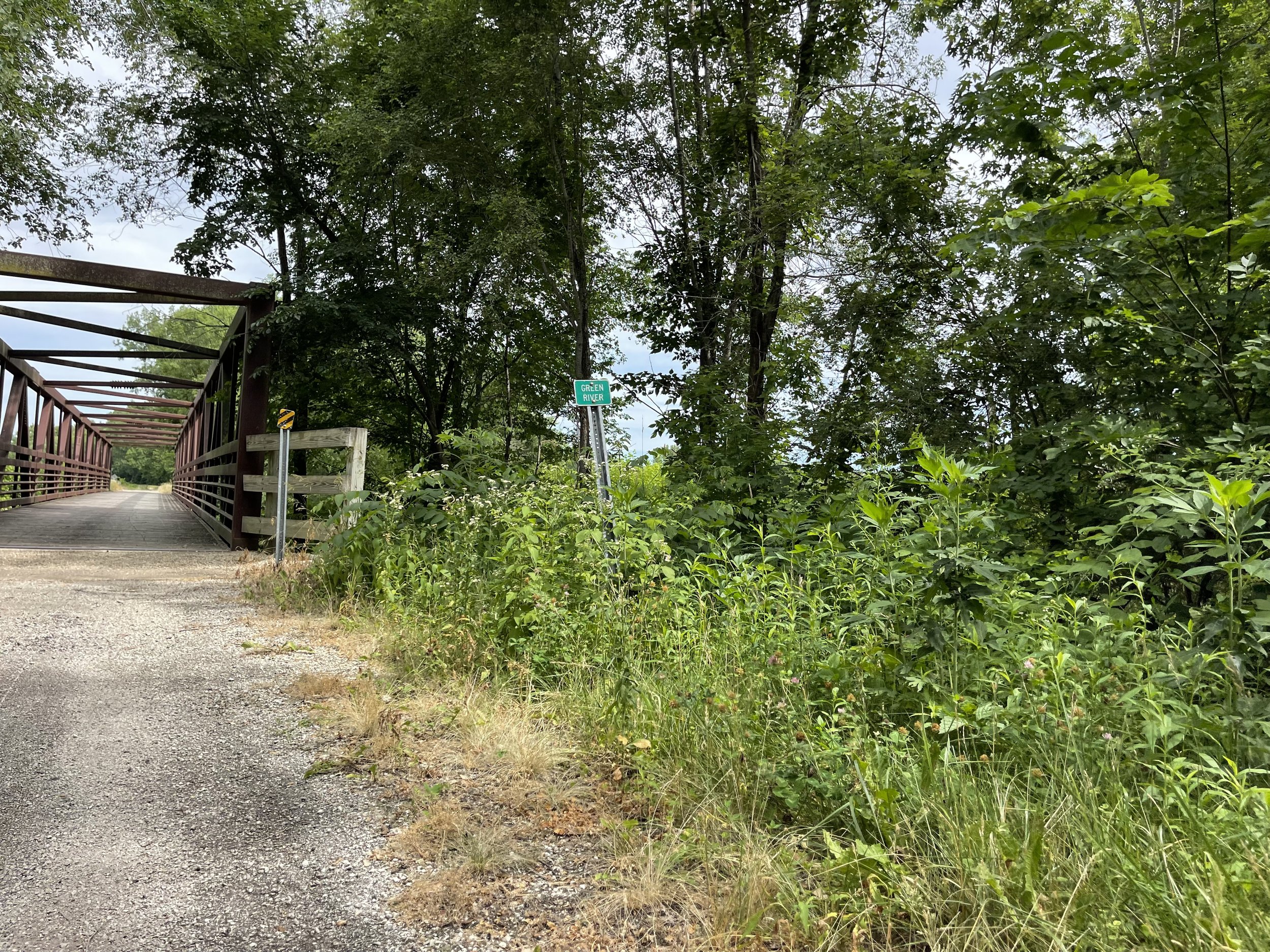
This is actually the second of two meeting points between the Hennepin Canal and the Green River. The first is a little more than 28 miles to the East, where the Hennepin’s feeder canal is carried over the Green River via a massive cement aqueduct. I was at that spot a few years ago - it’s something to see, with one body of water essentially floating overtop another. It is a decidedly unnatural thing. Unfortunately, the Aqueduct at this point is lost to time, replaced by a piping system that runs under the river to maintain the flow of the canal.
As far as being unnatural goes, this is a feature that the Canal and the Green River have in common. The Green River is largely a made made waterway itself, coming to life around the turning of the 19th century as part of a project to drain the former Inlet Swamp almost sixty miles to the east of this point. This project was undertaken to gain additional usable farmland, and, astonishingly enough, even back in the late 1800’s there was debate over whether the swamp should be maintained as a recreational wetland instead. I’m a little reluctant to admit that I have an ancestor - one Benjamin Franklin (yes) Johnson - who was, at one time, the commissioner of the Inlet Swamp Drainage District.
…So I guess it’s easy enough to determine where the family fell in the recreational wetland vs farmland debate.
But all that being the case, there are still wetland areas in the region, as is ably demonstrated a short distance further down the trail:

They didn’t drain this swamp

So many different shades of green
And in this area, as well as in others along the way, the canal has also taken a turn towards something more along the lines of a wetland:

Lillies
But not long after this point things get - and remain - decidedly more civilized:

Solid Asphalt
As I worked my way towards the end of the trail I was definitely in “town”, with settlement all around me. And not far from the end I encountered this:

Hennepin Hundred
It says that this is the finish line, but I was pretty sure that didn’t apply to me. I had places to be at the time, but I looked it up later on. The Hennepin Hundred is “Illinois’ only point-to-point, all-trail ultramarathon”.
I didn’t know this was even a thing, but that’s not surprising. I love cycling, but I’d sooner have my eyes gouged out with hot pokers than go for a jog. The event doesn’t occur until October, which is fortunate for me - if I’d selected an autumn date for this ride I might have ended up pedaling along with a pack of runners.
It was shortly after that sign that I came across the only underpass on the trip that I wasn’t willing to brave:
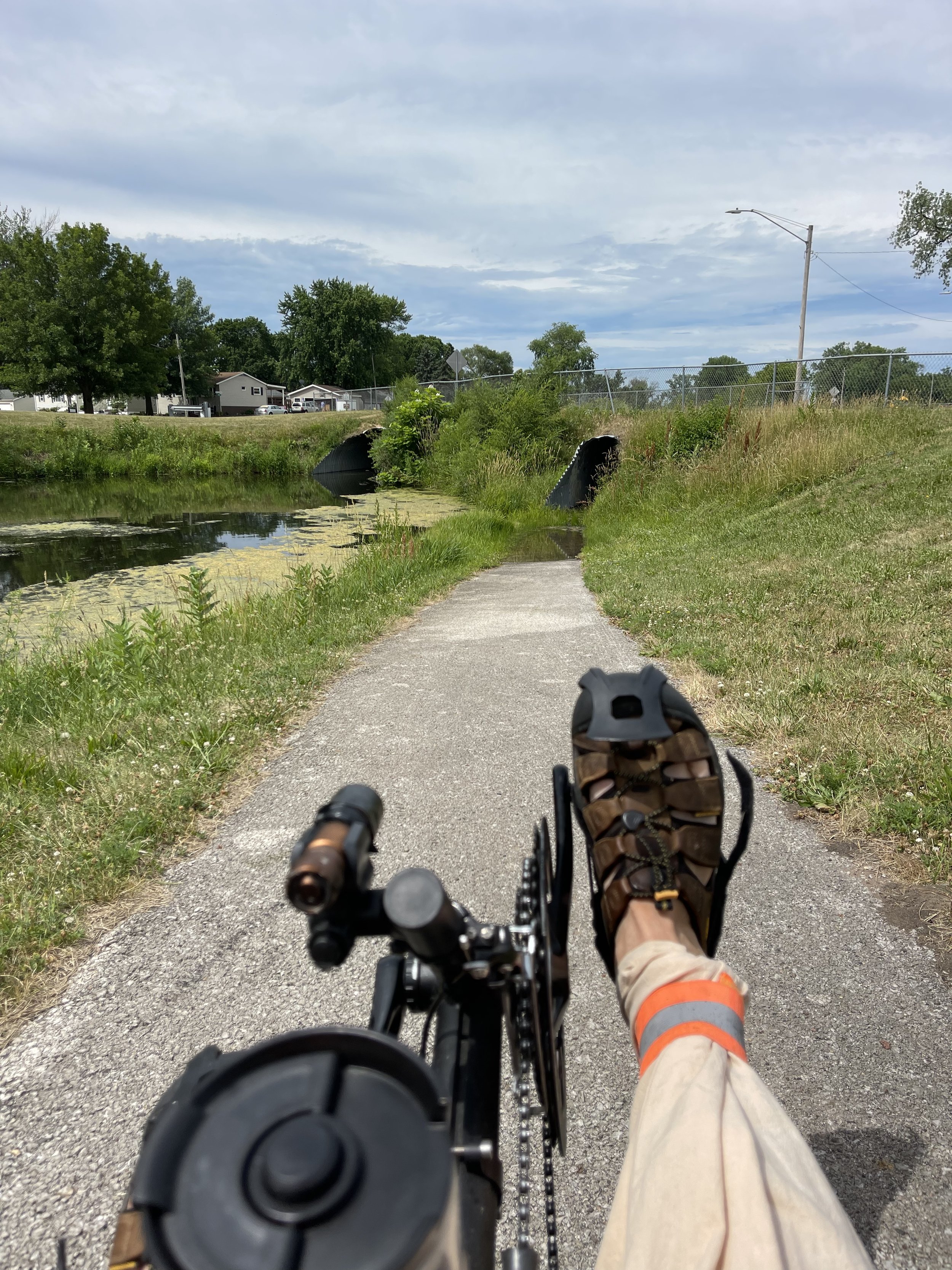
Yer gonna get wet. Real wet.
All of them have their own idiosyncrasies - uneven floors, sometimes a bit muddy at the start and end, a puddle right in the middle where it’s too dark to see - but this looked a little more… damp than I wanted to contend with. I rode up over the top.
It was a short distance from that point to the end of the canal trail. The trail itself signals that you have no choice but to turn around:

Loop-de-loop
There is one final lock at the end of the canal - Lock 29 (you just know that somewhere in the mix there had to be that one guy who was just looking for a way to add one more lock to the system to get a round number at the end…):

Resting at Lock 29
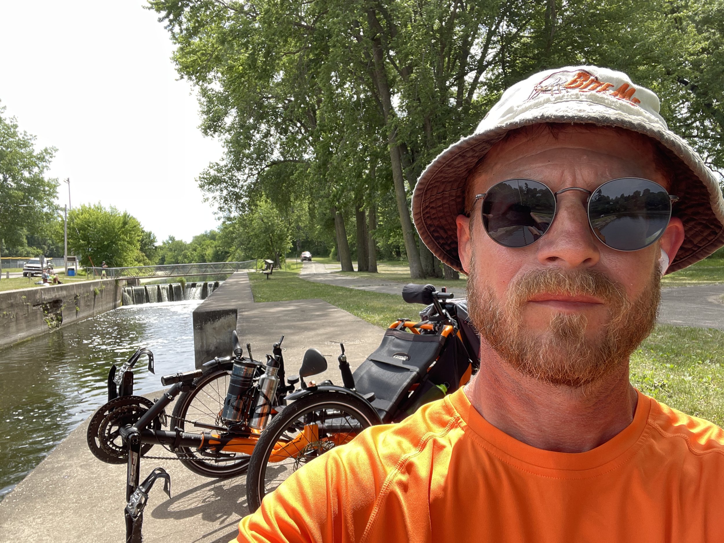
Me and my Val
And from here, the canal empties into the Rock River:

Canal’s End
At this point I wanted to be sure I took my lesson from Day One. I stopped, sat down on a bench, ate an apple, relaxed, and enjoyed the location, which included the rushing water from one last man-made waterfall:
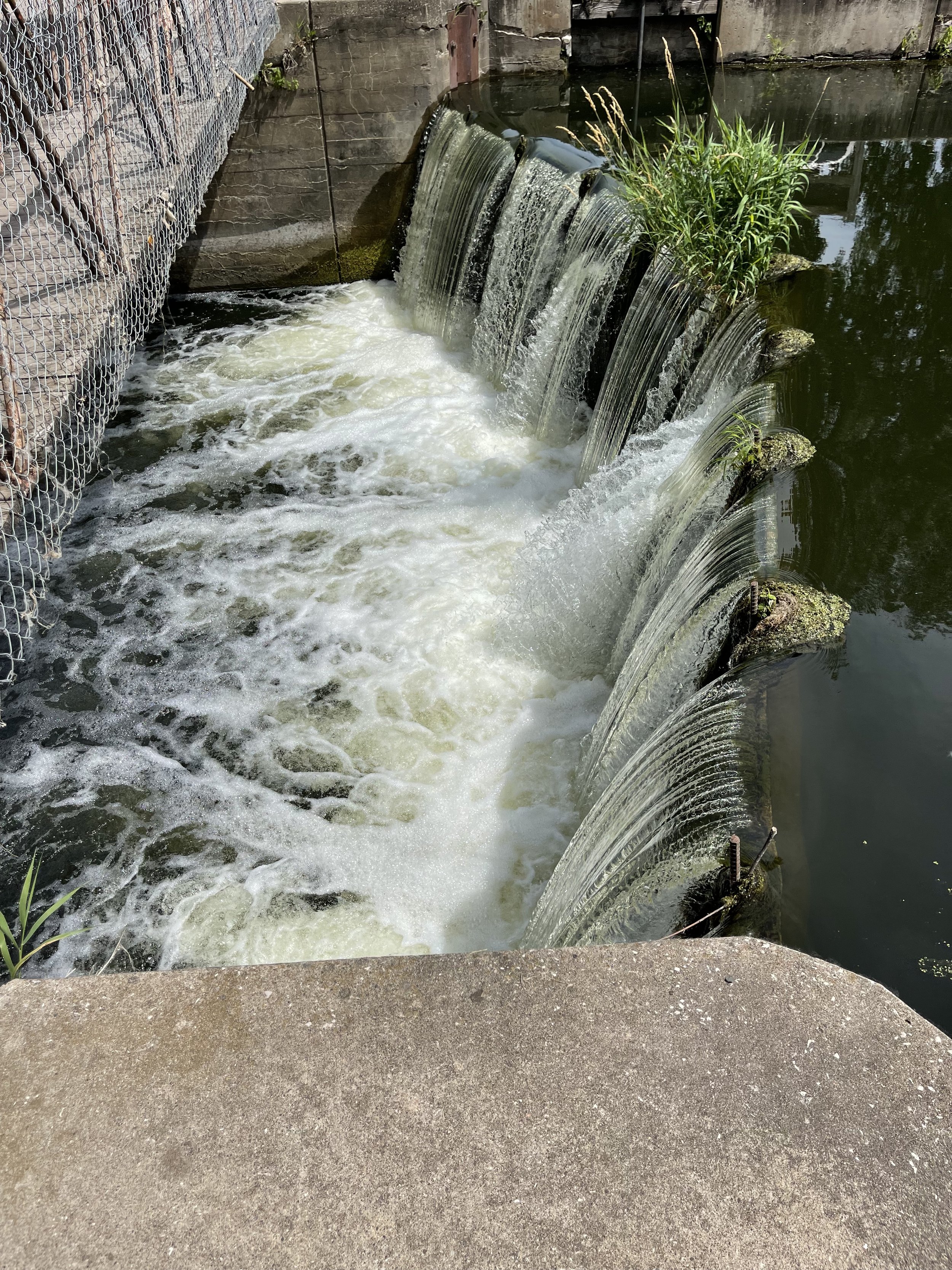
The last man made waterfall
And I contemplated moving across to the other side of the lock - which the map indicates is the trailhead. But the bridge across the canal had other ideas…

She’s not gonna fit
Nope
I can sort of imagine the discussion that led up to the presence of this bridge:
Bob: “Uh, Bill, the plan says that we need a bridge across Lock 29.”
Bill: “We’ve got about 50 feet of metal left, and maybe five bucks worth of scrap lumber. Will that do?”
Bob: “Its good enough for government work!”
I would hear my Dad say that last phrase often when I was a kid, usually at the point where he had decided he’d worked long enough on something that might not be a finished as it could be. It was only later in life - when I see a huge sign on the highway that says “bump”, or a bridge like this, that I fully appreciated what he meant.
The completist in me briefly considered carrying the trike across, but the realist immediately imagined dropping it into the canal and told the completist to shut his pie hole.
From this point the Rock River follows a somewhat winding course for another 13 miles before it empties into the Mississippi. When I had started thinking through this ride, my initial idea was to follow the Rock from that point, fully recapitulating the course from the Illinois to the Mississippi. Unfortunately, I couldn't find a way to make that work that looked at all attractive from a riding perspective. While there are streets that get you there, large portions of the roadways looked to be major highways or at least heavily traveled, and in commercial areas. So I laid out a different path to get to the mighty Mississippi.
Once I’d had my fill of fruit, and I was rested and relaxed, I headed out to reach - and cross - the Mississippi.