Trikepacking

Hennepin Canal Trail End to End - Lessons Learned by Erin Wade

At the end of June of this year I took a ride along the Hennepin Canal Trail from the trailhead at Bureau Junction to the western end - or what I thought was the western end (more on that a little further down) - of the Hennepin Canal Trail and back.

This three day, 150+ mile ride, involving two overnight stays at Geneseo Campground in Geneseo, and took me across the Mississippi into downtown Davenport, Iowa, was my first real foray into trikepacking. The closest I’d come to it before this was car camping for the overnight stay at the Hilly Hundred last year, but that didn’t require me to carry everything on my ride. All in all I think I was fairly well prepared for the trip, but there were definitely a few things to learn from it as well.

Distances

As those who are clever with the maths will already have sorted out, my ride was set at about 50 miles per day. Or at least that was the average across the three. It was a little lopsided in practice, with 48-mile distances on days 1 and 3, and 58 miles on day two.

I’ve taken many 50~ish mile rides over the past few years, and I’ve gotten to the point at which, while it still feels like a long ride, this type of distance isn’t daunting. And those distances usually take me around four and a half hours, including a couple of breaks for snacks and to get up off the trike and move around.

I knew the canal trail would be slower - it always is. The softer surfaces over the first two-thirds of it just make for lower speeds. I thought I’d mentally compensated for that.

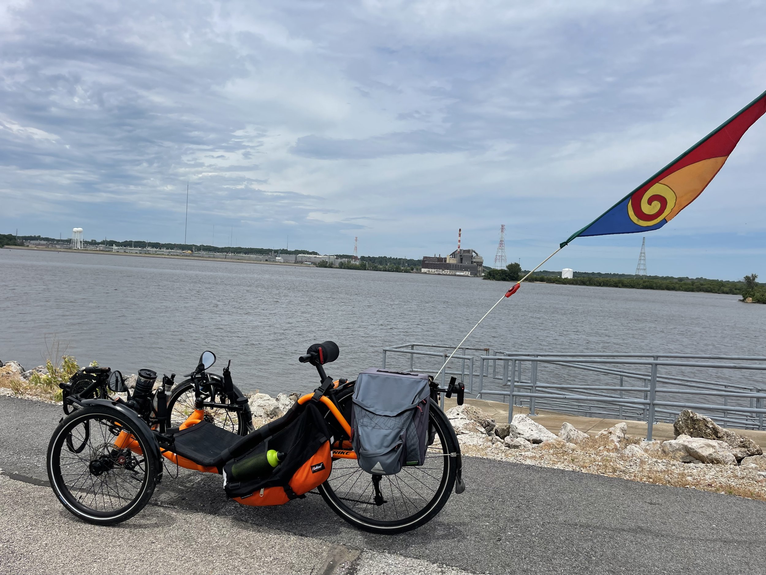
But I went into the ride planning to take my time, to stop and take pictures, pose the trike strategically…

Valencia on the Canal

…because this was supposed to be fun and relaxing. But I didn’t account for the amount of time this would add. So - when I got just past the halfway point on day one and realized that I was going to be running out of daylight for setting up my tent at the campground, what had been a very enjoyable ride up to that point now became one where I felt I had to push and make distance. What had been fun rapidly became more like being at work, which was the opposite of what I’d intended.

So - for future overnight rides, I think I’ll set the distances in relation to travel time a little shorter to account for that, especially on any day where I have to set up camp at the end of the day. Better, it seems, to have a little extra down time at camp than to be pushing to get there ahead of sunset.

Equipment

Overall, I have to say that the equipment that I put together for my trip performed flawlessly. Everything worked exactly as designed.

The Peak meals were all good, and with one exception - Chicken Teriyaki and Rice - I would actually qualify them as excellent. I will be bringing them along on future trips, cycling or otherwise.

The little Jetboil camp stove worked as designed, rapidly heating up water for those meals and for coffee, making for multiple satisfying camp meals. It was also efficient - I made four meals and two travel mugs worth of coffee across the three days, and did not even use up the first fuel cell.

I brought along three portable batteries to charge devices, as well as cables to charge the devices and the batteries themselves. This was overkill. Because my campsite had electricity I was able to charge my battery, and one turned out to be more than enough. I could have saved a little weight in that area. Otherwise I used nearly everything I added for the trip.

MLW bought me a clothesline, which was great for hanging clothes that I’d rinsed out from day one, and a little battery fan with a light on it which did an excellent job of moving air in my single-person tent. This was a good thing too, because I ended up spending a lot more time than I planned in the tent on the morning of day three.

Which brings me to the only equipment concern that I encountered - the tent.

One single-person bright orange tent - check!

I say “concern” here, because the tent also performed nearly flawlessly. It held me and had enough room to provide protection for some of my things that I wanted in out of the weather. Paired with the lightweight inflatable pad I brought along it was comfortable - the all mesh top, paired with the little fan allowed for airflow and star gazing in the night, and the separate rain fly provided cover and protection from the elements when it was needed. It did develop a small leak during the heavy storms, but nothing unmanageable, and which probably could be resolved with a little seam sealer (which one might argue I should have applied before packing it anyway). It worked well, it worked as designed.

It’s the design itself that I’m having second thoughts about. It protected me well, even during storms. But it was clearly designed just for you to sleep in. Having to spend several waking hours inside it because of the rain pointed out to me that you cannot sit up in it. This resulted in a lot of time leaning on one elbow and then the next, swapping when the pain was finally too much to bear. For future overnight rides I may need to invest in something slightly larger to allow for the option of sitting upright.

The Trike

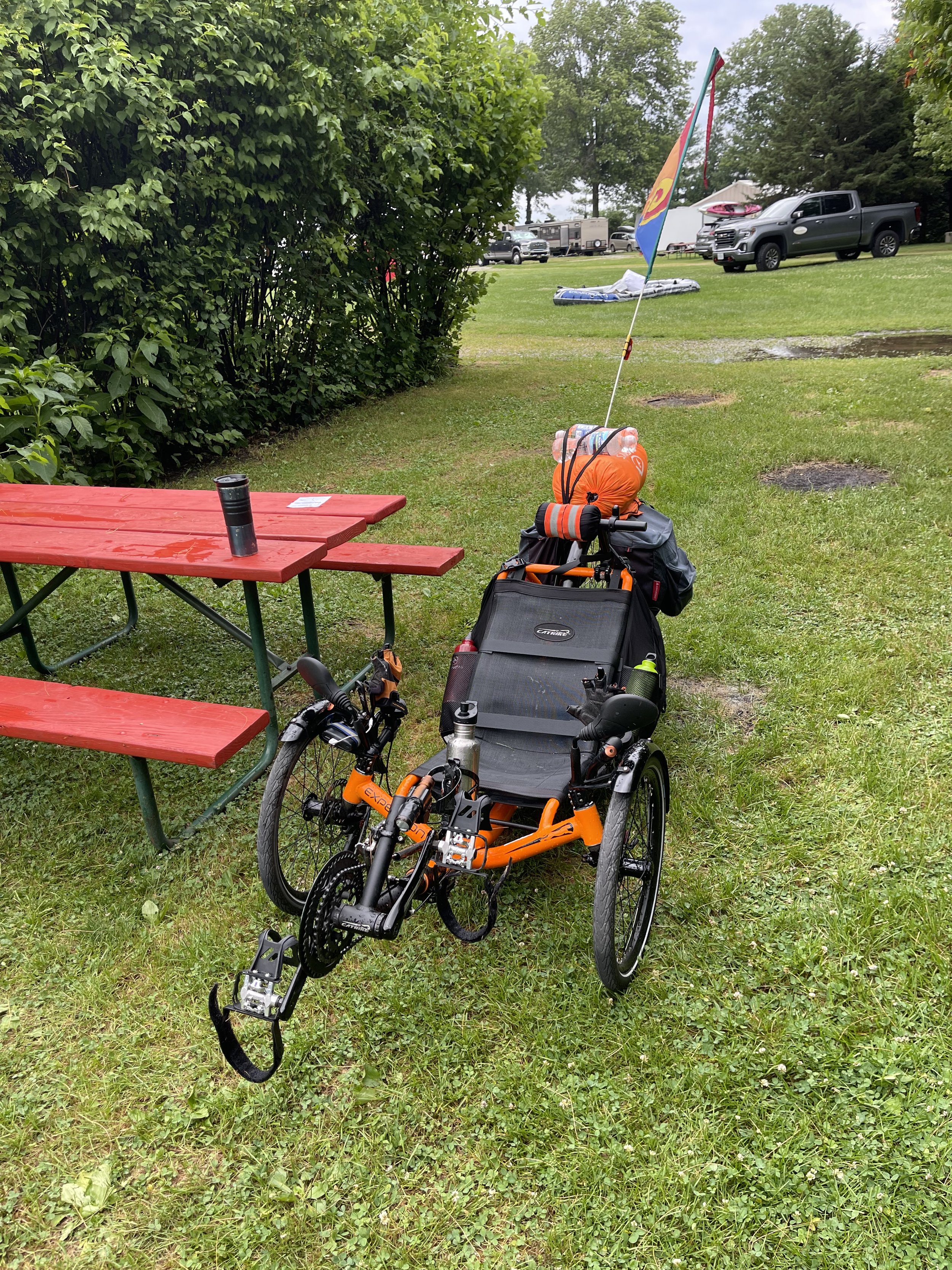
My ride for this adventure was my 2019 Catrike Expedition. Back when I bought it in the summer of 2019 I’d ordered it with this sort of riding in mind. That meant including a rear rack and a set of pannier bags, and I’ve routinely been riding it in that fashion since it arrived. But for this trip I needed more cargo capabilities. I considered pulling a trailer, and then did some experimentation with stacking items on the back of the rack. However, the post about that experiment led some folks to suggest a couple of different options of supplemental bags that hang across the back of the trike’s seat, bringing the weight down lower for a more advantageous center of gravity. I went with the Radical Designs Banana Racers, which the Hostel Shoppe in Steven’s Point, Wisconsin special-ordered for me in Orange (naturally).

These worked perfectly - in combination with the pannier bags they swallowed everything I was carrying with the lone exception of my sleeping bag (which I strapped to the top of the rack). And, as described, they put the weight of the cargo down low, exactly where you want it. Plus, the bottle carriers on the top of each bag keeps your extra fluids right in reach. It’s an extremely well thought out design. And - because they essentially lay across the back of the seat, easy enough to remove when you get home and aren’t in need of the extra capacity.


Enjoying this post? Check out our Cycling page for links to other cycling articles on Applied Life


As for the trike itself - it’s right there in the name. She was built for expeditions, and handled all of the weight without issue. This ride covered multiple surfaces - from dirt and sand trail to asphalt and cement roadways. I knew the weight was there whenever I tried to move the trike by hand - on a regular day, when it’s not fully laden and I need to move it somewhere I typically grab it either by the back of the rack or by the handle on the neck rest and lift it a bit to steer it where I want it to go. The first time I tried this it was clear I wouldn't be just lifting it and tossing it about. But once I was underway the weight was barely noticeable.

And - in further testament to the design, two thirds of this ride was thru the middle of nowhere, with (as far as I’m aware) nothing resembling a bike shop anywhere nearby. I had my tools with me, and I’ve gotten a lot of practice making adjustments and repairs over the past few years, but there were no mechanical issues - not even a flat tire - for the entire trip. I had a similar experience last year during the Hilly Hundred, where I rode past many a person on the side of the road, making repairs to their very fancy road bikes, while I had nary an issue. These machines are built to live up to their name.

Do your Homework

Part of the established objective for this ride was to:

Recapitulate the original purpose of the Hennepin Canal - connecting the Illinois River to the Mississippi at the Quad Cities…

In looking at this, after my entry about the second part of day two, one gentleman online asked why I was riding into the Quad Cities and across the Mississippi when there was still Hennepin Canal trial to ride up to the Mississippi.

And… he was right. I thought the canal trail ended at Timbrook Field, where it empties into the Rock River - this is the way it looks on the map. I even made a joke about how frustrating it must have been to have only 29 locks instead of rounding it up to 30…

There is one final lock at the end of the canal - Lock 29 (you just know that somewhere in the mix there had to be that one guy who was just looking for a way to add one more lock to the system to get a round number at the end…)

I felt very clever…

For the record, there are 31 locks on the canal (also, distressingly, not a round number - but I digress). The canal stops at Timbrook field, but picks up again several miles down the Rock River and follows it till it empties in the Mississippi.

I’m going to openly admit I did not know about this last portion of the canal trail. But when I first started considering and laying out this trip, I did initially look for a way to follow the Rock River into the Mississippi. The thing is, while there are bike trails that start to appear as you get to the western end of the Rock River, much of what’s between Timbrook Field and the Mississippi along that route is major roadways and what appears to be commercially zoned territory. It did not look inviting for cycling, nor did it appear to offer anything like the very nice lunch opportunity that I found in Davenport.

In fact, it doesn’t offer a bikeable bridge across the Mississippi at that location at all, so I’d have had to backtrack and ride through the Quad Cities one way or the other to nearly the same spot to get across in either case. And I wanted to cross the Mississippi specifically at the Arsenal Bridge (also known as “Government Bridge”) because that’s supposed to be where The Great American Rail Trail marks its crossing from Illinois into Iowa.

Speaking of which…

The Great American Rail Trail

I love the concept of The Great American Rail Trail (GART) - a coast-to-coast cycling trail across the country. I love it so much that I can even set aside, and not even comment on the fact that the overwhelming majority of the trail in Illinois is based on two canal trails - the Hennepin and I & M Canal trails - and so aren’t rail trails at all.

See how I’m letting that go without even mentioning it?

The route I followed from Timbrook Field doesn’t exactly mirror, but does closely follow the planned route the GART (I used Google’s cycling directions for my route).

GART Route

I wanted to get an idea of what this route was like now, an on-the-ground impression of what was still needed.

And there are absolutely improvements needed.

To their credit, Rails to Trails has done an analysis of this gap in their conceptual trail, and they pretty much peg the biggest problem correctly:

Most of the streets that are planned to be on-street signed routes are low-volume, low-speed roads, though the route is currently proposed to cross the Rock River on state Route 84/Colona Road, a major arterial road. A physically separated alternative should be explored in this section. (Emphasis added)

Yup - that section of Route 84 is four lanes of traffic and represents what appears to be the only bikeable bridge across the Rock River for miles in either direction. It is what Google identifies as their bike route across the river, and it does have a very wide shoulder. It’s only a mile of the trip in each direction, but it’s a butt-puckering mile. A separated cycling bridge is desperately needed there, along with an overpass to cross the highway where needed.

Also - for anyone looking at this route for themselves, I’d follow the course thru the towns of Carbon Cliff and Silvis laid out by the GART proposed map over the Google cycling directions. I’m generally comfortable riding on roads, and everyone was respectful of my space on my trip, but Google puts far too much of it on busy roadways.

It all leaves me wondering about the likely success of the GART, at least here in Illinois. There are only 28.8 miles of gap in Illinois, which seems like a small number. But much of that gap is between areas that are in rural and marginal land - along the Illinois river, for example. And the canal trails themselves are in need of resurfacing and ongoing maintenance attention if the intention is for the GART is meant as a realistic coast-to-coast byway.

But that depends on whether that’s really the intention. It is the concept, but if that’s meant just to drive an expansion of trails nationwide, then maybe its already doing its job. Still, I am a little distressed to see that, when they highlight the eight-of-twelve states who “will have added new trail segments since the route was initially developed” Illinois is not one of the eight.

Overall

Overall I enjoyed the trip! I was pleased to find that I still enjoy camping, and three consecutive days on the trike, with two of them deep in natural solitude was definitely a positive for me. If that sort of activity is your thing, the backdrop of the Hennepin Canal is a wonderful thing, with lots of nature available, intermittently punctuated by examples of human ingenuity in the form of the locks and lift bridges.

The things that I’ve learned in preparation for this trip, as well as by taking it, should allow me to improve and extend my enjoyment for the next time out. Shorter distances, in particular on those days where I’d need to set up camp at the end, would go a long way towards making the ride a little more relaxing.

So now I’ll be looking for additional opportunities. I’m not sure if I’ll be able to fit anything else in this summer - multiple day rides are hard to fit around a work schedule, and we are starting to run out of season. But I’ll definitely be working out something for next year, if not this fall.

Hennepin Canal Trail East to West and Back Again - Day Three by Erin Wade

The Idea: Recapitulate the original purpose of the Hennepin Canal - connecting the Illinois River to the Mississippi at the Quad Cities - by riding it from its eastern end in Bureau Junction to where it empties into the Rock River at the western end at Timbrook Field in East Moline, and continue on from there to the Mississippi River and across into Iowa. And then, of course, turn around and reverse the trip back to Bureau Junction.

6/25/2022 - Geneseo Campground to Lock 2 in Bureau Junction - 48 Miles

Rain.

I felt the first drops sometime around 4:30 AM. I was sleeping with the rain fly open, so the mesh top of the tent was open to the sky; and hence, to the rain. Fortunately, those first few drops were light - enough to wake me, but not to drench or wash me out. I unzipped the mesh and pulled the rain fly down, zipped it all back up, and went back to sleep.

The tent did it’s job - I was dry and comfortable until I woke up in earnest around 6:30 or so. This wasn’t due to an alarm, or issues with the weather, just my natural wake cycle.

But while I was awake - and still dry - the world outside my tent was decidedly not. Those light drops of rain had precipitated a storm system that was still diligently pounding down on my campsite, moving along a easterly track, essentially scouring ahead on the path I was planning to follow that day.

I had planned to be on the trail by about 8:30 or so, if not earlier, trying to apply the lessons I’d learned about departure time from day one. Instead I found myself laying there, watching the radar on my phone, looking for openings in the rainfall.

About an hour later - around 7:30 or so - it opened up enough to allow me to get out of the tent, take care of personal sundries, and get some breakfast - Peak Refuel Breakfast Skillet (very yummy!) - and coffee made. But only just. As I was getting that all put together the storm started to roll in again, so I gathered up my food and coffee and ducked back into the tent.

I love the idea of this tent:

My tent

It’s a lightweight, single-person tent clearly designed primarily to provide cover and protection for its occupant and a few personal items overnight on a trip very much like this one. And it works great at all of that - I was kept safe from the elements aside from one tiny drip (which I can address with some seam sealer). It was comfortable, and had room for the little battery fan MLW cleverly got for me, which effectively moved the air in the tent while everything was closed up. It performed as designed.

What it did not do - could not do, by design - was allow me to sit up. This hadn’t been a consideration for me, since the only thing I was planning to do in it was sleep. But I hadn’t considered this situation.

I ducked back into the tent probably around 8-8:15-ish. It continued to storm until about quarter after 10. And when I say storm here, I mean wind, rain, thunder and lightning (I’ll ride in rain, but I’m a-skeerd of lightning). So I spent about two hours alternating between being propped up on one arm and laying on my back. I ate my food, drank some coffee, and did some work; and spent much of that time trying to decide at what point the pain in my arm and shoulder was simply too much and I needed to lay back down.

I still love the idea of this tent, but for the next trip I think I might need to do a search for a lightweight tent that is more upright. Or, alternately, see if there is some sort of lightweight tarp system I could bring along to allow me to get out of the tent in the rain. It would have been nice to have that in any case, since the trike - with my cargo bags - was out in the weather the entire time. But I’m pretty sure anything with open sides would have left me damp during the storm.

As the rain cleared I got out and started to get things ready. Although the trike and bags were out in the rain, pretty much anything that I was worried about keeping dry was either in waterproof bags, or in the tent with me. So mostly it was now a matter of emptying the bags out to get the water out of them, and then repacking them and taking down camp. I was ready to hit the trail just after 10:30:

Val is ready to go

This was, of course, two hours later than I’d planned. But then, they say that men planning is what makes God laugh, so at least I’d contributed to someone’s entertainment for the day.

While I wasn’t able to apply all my lessons from day one and get on to the trail as early as I wanted, I did have the two additional bottles of water along for the ride so I wouldn't run out on the way back.

And I knew the ride back was going to be slower than the ride up because the unpaved portions of the trail - the portions like this…

Dirt with a side order of sand

…would be softer - and soft is slow. But while I’d mentally accounted for the surfaces, the storm rolling along the trail ahead of me provided other obstacles. One was fairly predictable:

But… but… it’s a Catrike, not a Ford…

Fortunately, while the water was over the path, it wasn’t very deep. Most importantly, it was below the level of the seat, which meant I wasn’t dragging my backside through it. Several years ago, riding the Feeder Canal, I discovered that it was possible to hold yourself up above the seat by pressing your back against it and lifting up at the handles (though you don’t want to have to do this for very long), but that wasn’t necessary here.

The others I hadn’t expected, though I probably should have:

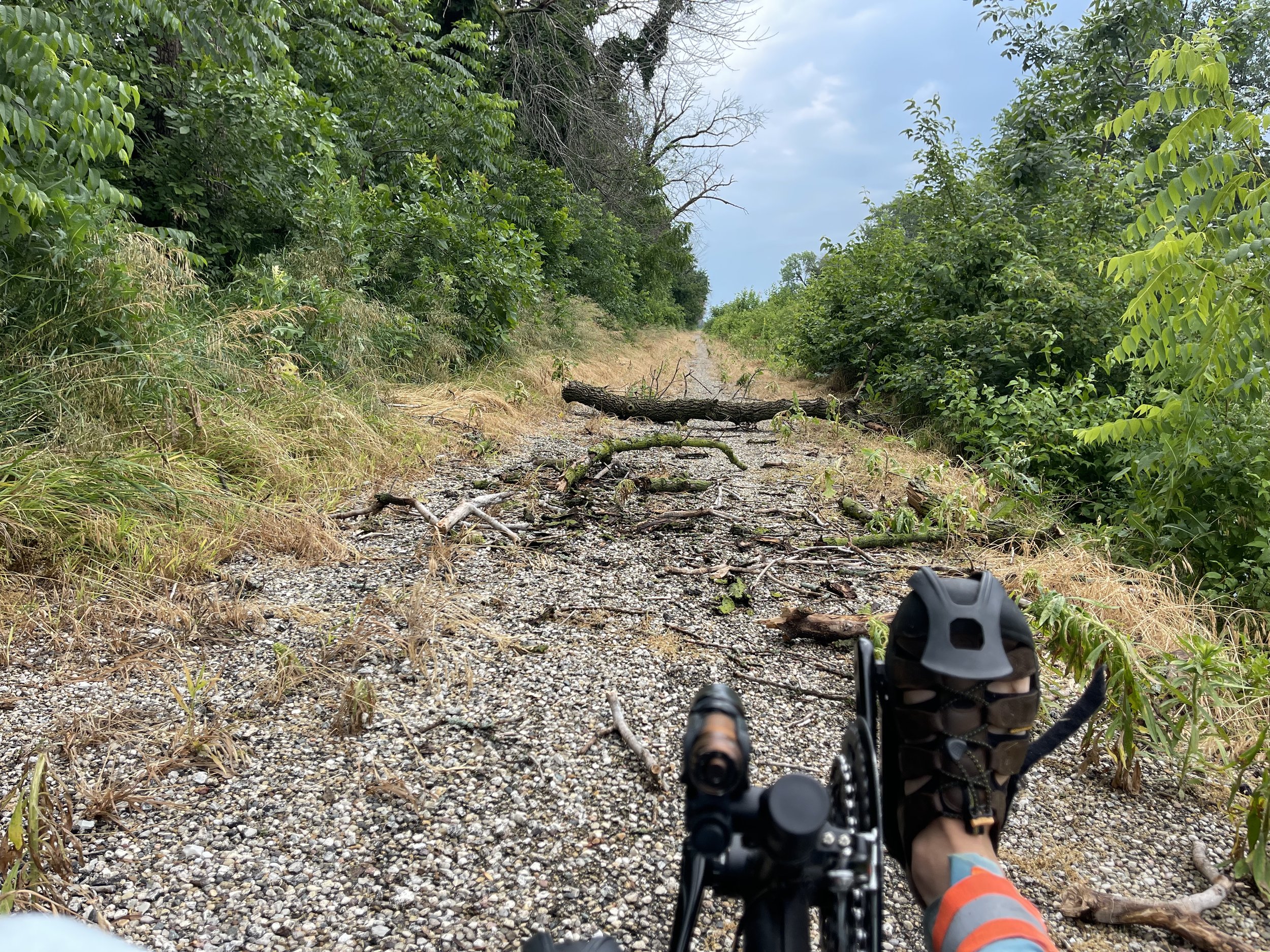
This is not the kind of windfall I was hoping for…

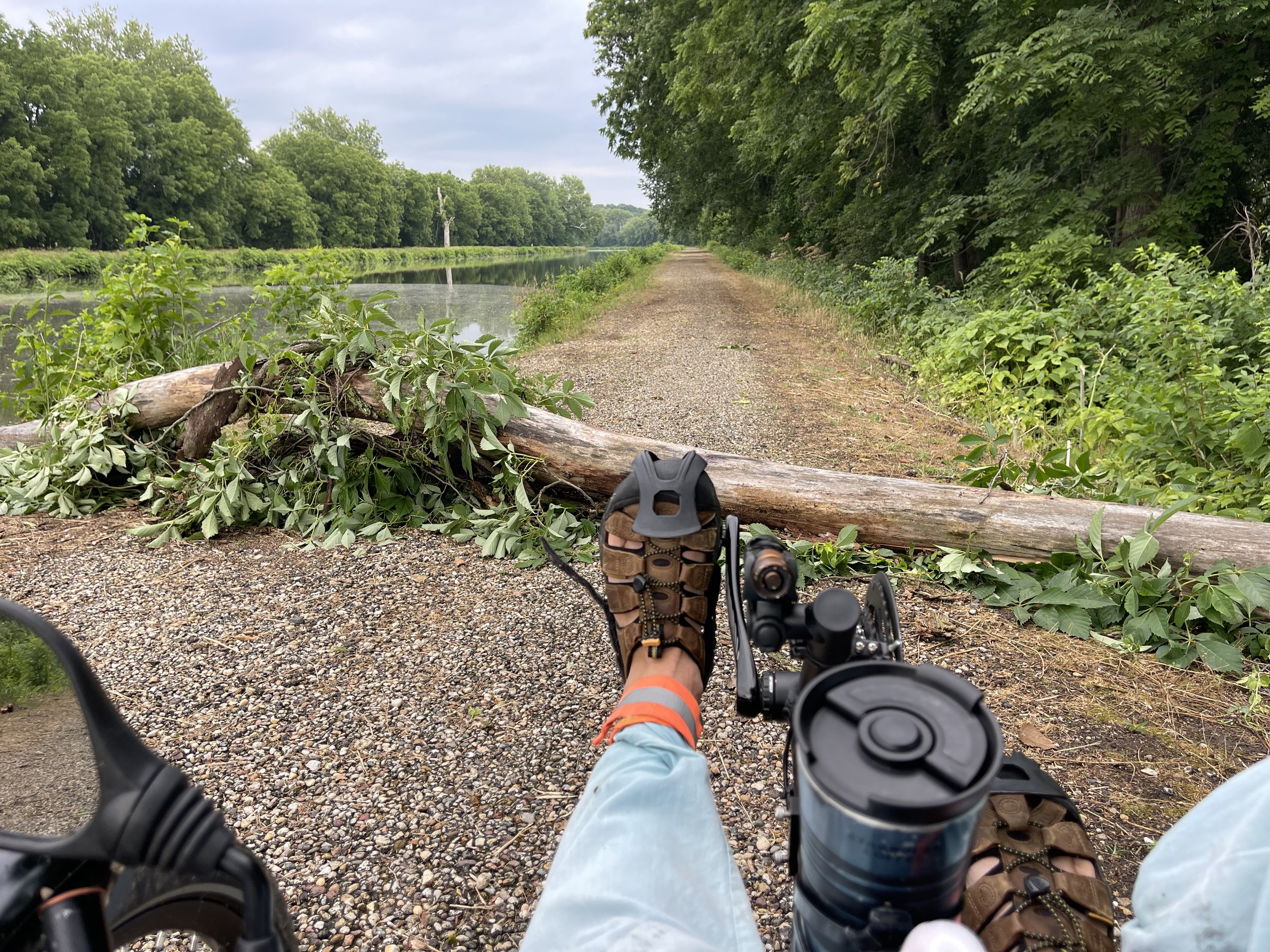
There were three of these along the way. This one was the first that I encountered, and in this case I dismounted and cleared it out of the way:

That’s more better!

The second one I did not get a picture of, but it was branches laying across the trail around my standing chest height. There was no way to get to them that allowed me to move them out of the way, but the trike is much lower than my standing height, so I was able to pick my way under those with the trike. And the last one showed up towards the end of the ride:

Man down!

Maybe, if I hadn’t been riding for hours, I would have had the gusto to pick it up and move it, but I doubt it. A brief attempt found that it was resolute in its intention to lay across the trail, and I suspect it will take a person who is equipped with a chainsaw to get it gone. So here I just shook my head and carried the trike over it.

But having the storm proceed me along the trail wasn’t all bad. The rain knocked down the tall grass on the early portions of the trail…

Take that, tall grass!

…so I was able to proceed along this time without becoming a grass seed collector, like I had on day one. Not as good for my future artisanal grass seed business, but it kept me from having to pick seeds out of… well… everywhere.

One might think that day three is simply a reversal of day one, and to some degree I suppose that’s true. And given that riding along the canal puts you out in nature, albeit man-made nature, all day, which means you spend a lot of time with views like this…

So the frogs don’t really sit on top of the lily pads that much - Kermit and cartoons lied to me…

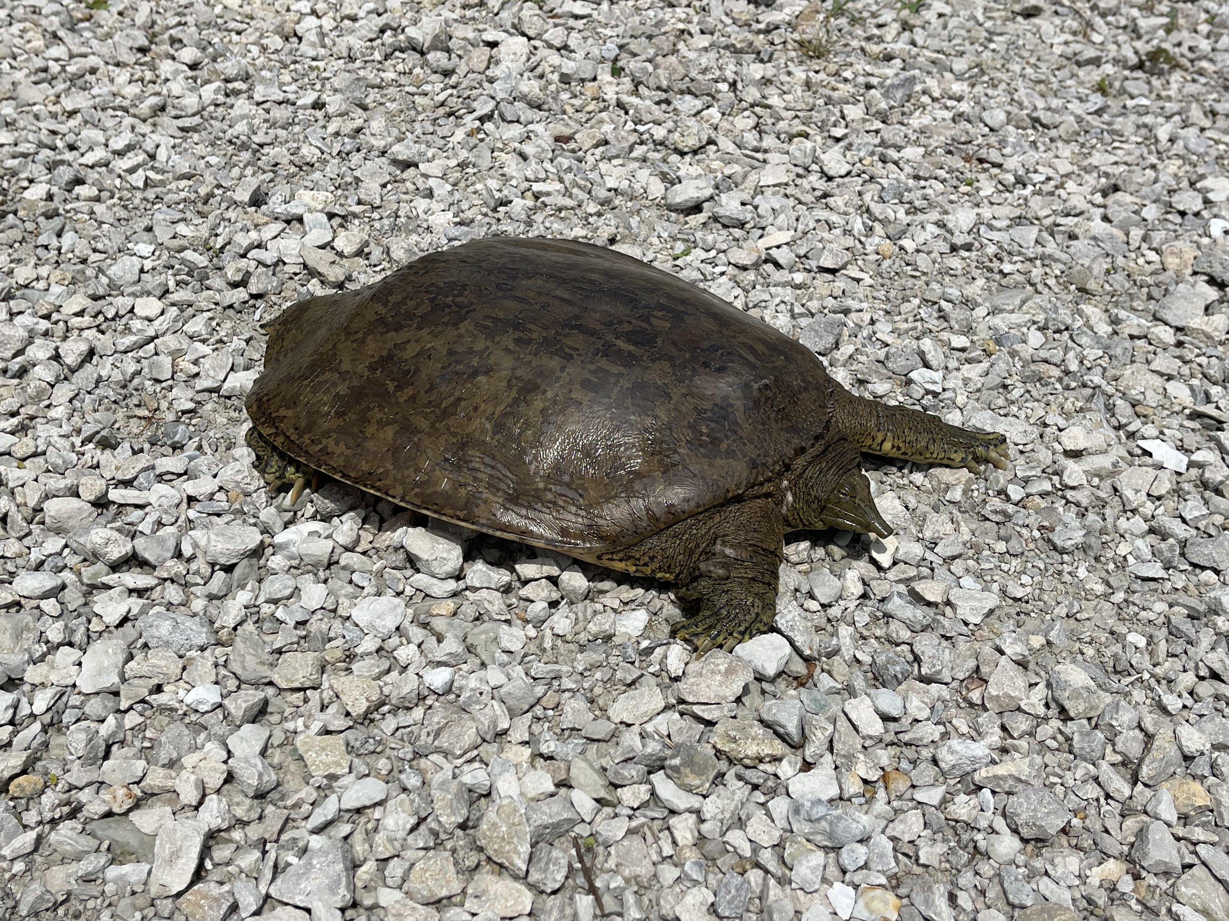
…and encountering fellows like this…

Soft shell turtle

…it’s hard to think of that as being a bad a thing.

But coming at things from the other direction does mean that you are seeing things from the other side. And so when I came across this, I realized I hadn’t seen it on the way up:

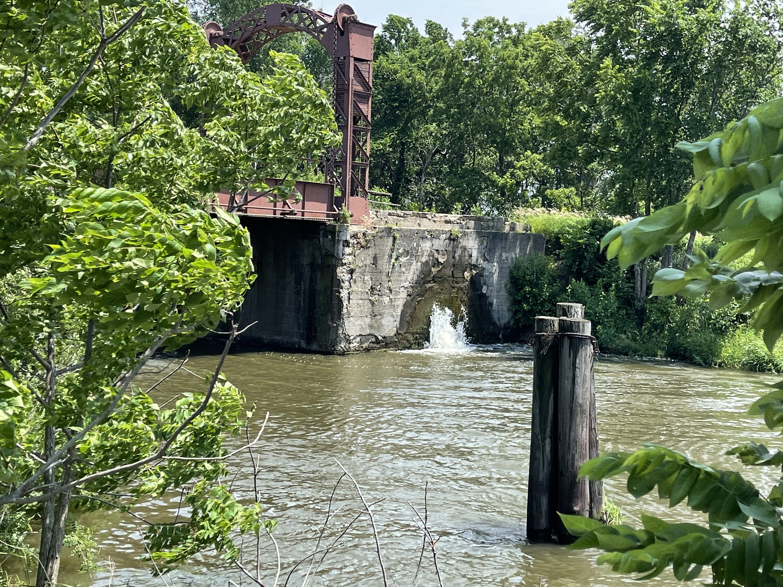
Water plume

Water plume

As you can see from the water mark on the concrete, the water is coming up under pressure in bursts. I have no idea why - I don’t know if this is a feed from a tiling system, or where the additional water would be coming from. But it was oddly soothing to see and listen to, a little like waves crashing on the shore, I suppose. I ended up sitting there and watching it for a little while before I moved on.

And it would have been behind me on day one, as well as being more towards the later part of that ride, where I was trying to get to camp, so I didn’t notice it at all. And, because of that dynamic, I was now able to spend some time on things that I did notice, but had to simply ride past because I needed to be somewhere. Most notably, this lift bridge.
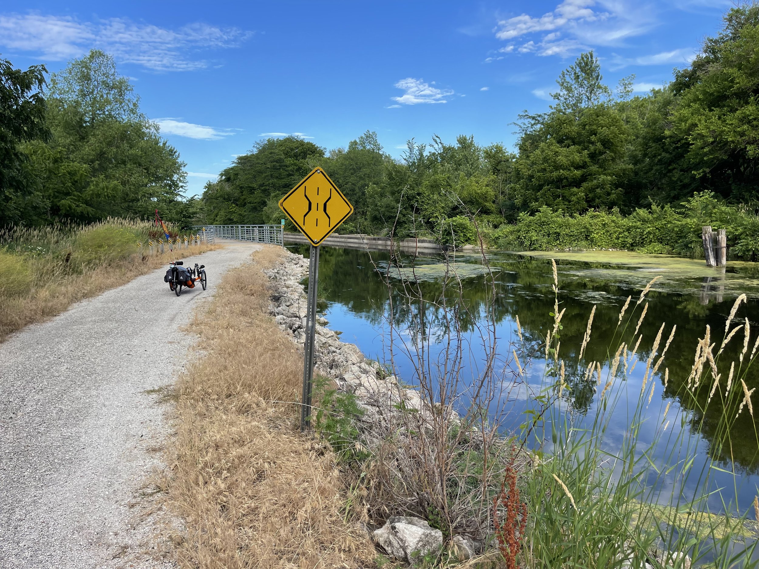
Bridge to… Terabithia?

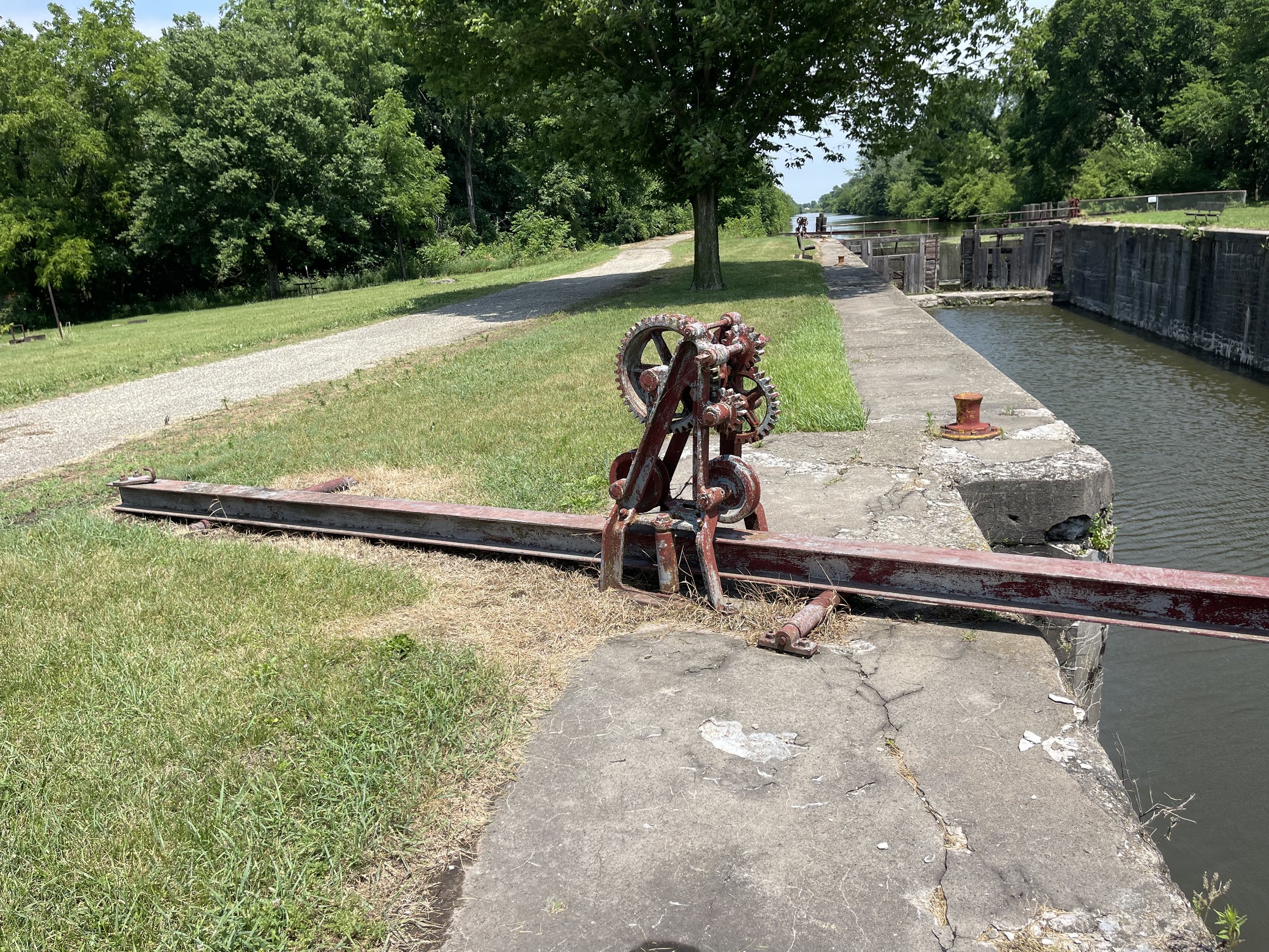
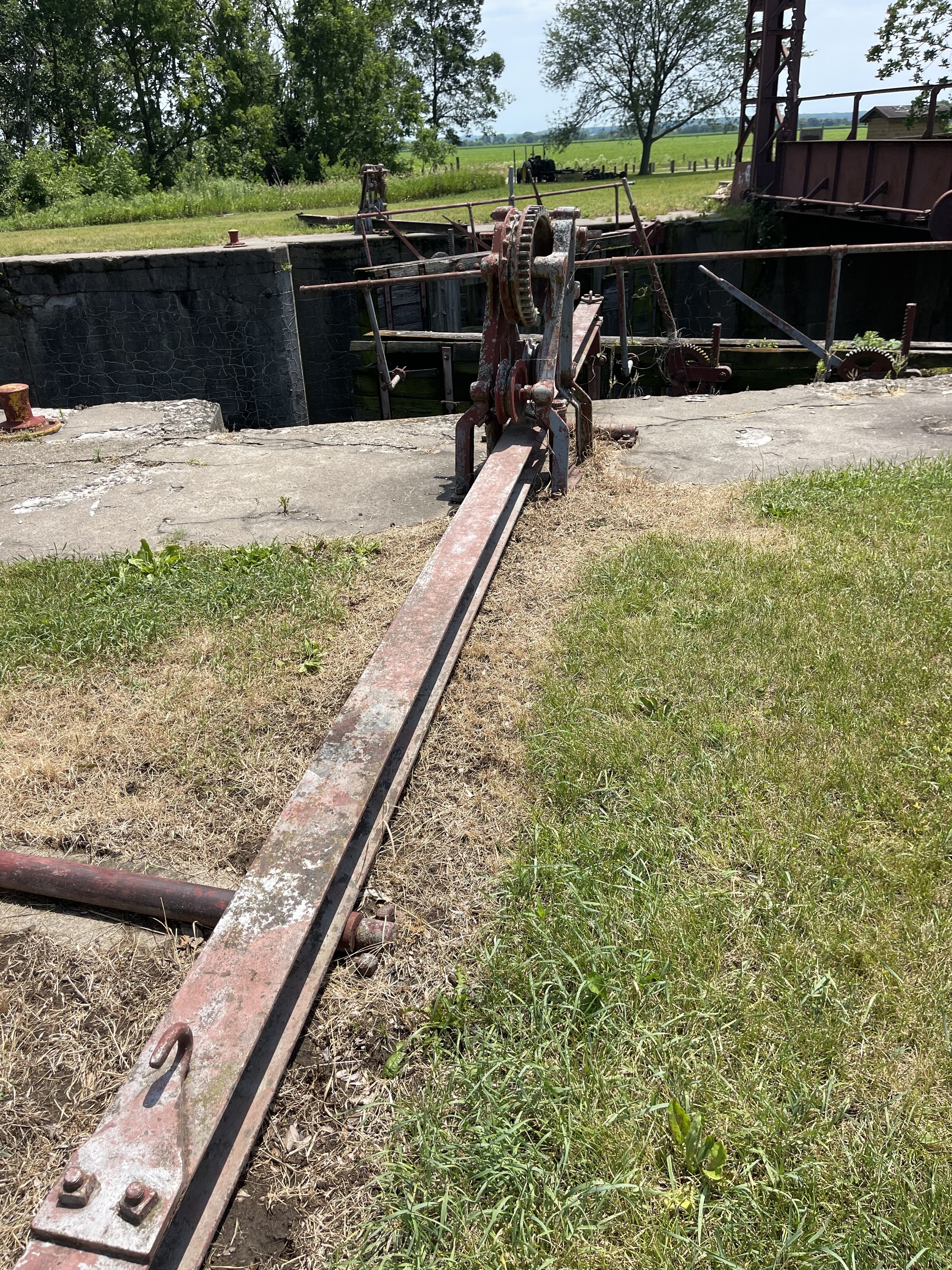
Unlike most of the locks, the gates and hardware are still present at this site:

Gates

Hardware

Hardware

Hardware

The other thing that is different going from west to east is that the trail mileage markers are counting down. Since it was the last day, and I was on my way back, it gave a real feel for where I was at on the ride, and how much progress I was making. And as I got into the last hour or so, I was in much more familiar territory; I was on the parts of the trail I’d ridden several times before. So a lot of it was simply enjoying the nature and counting things down on the markers as I pedaled along.

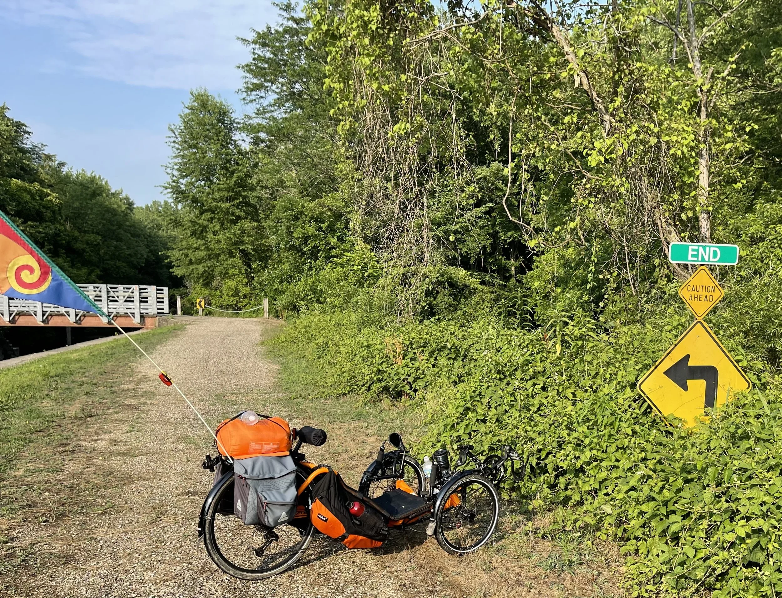
But while I was enjoying my ride, I was still glad to see the end when it arrived:

The End… of the trail

As I’d expected, it was slow - both in terms of riding speed, which came out to an an average of 8.15mph for this portion of the trip - and in terms of total time. I arrived at the end of the trail at a little after six in the evening. All told, between the soft surfaces and obstacles, the ride back took me over 7 1/2 hours to complete.

Of course, that’s 7 1/2 hours of nearly complete solitude, in nature, so taking a little more time is hardly a bad thing.

Hennepin Canal Trail East to West and Back Again - Day Two, Part Two by Erin Wade

The Idea: Recapitulate the original purpose of the Hennepin Canal - connecting the Illinois River to the Mississippi at the Quad Cities - by riding it from its eastern end in Bureau Junction to where it empties into the Rock River at the western end at Timbrook Field in East Moline, and continue on from there to the Mississippi River and across into Iowa. And then, of course, turn around and reverse the trip back to Bureau Junction.

6/24/2022 - Timbrook Field in East Moline IL to Davenport Iowa via the Arsenal Bridge, then back to Geneseo Campground - 44 Miles

I’d gotten to Lock 29 at Timbrook Field on the Rock River, but that was only the first part of the trip planned for day two. The next stage is planned was to ride from there up to the Mississippi Riverway Trail, and cross the Arsenal Bridge to get to Iowa.

On The Road

The first part of this was the section in which I was least confident. Using the cycling directions in Google Maps I’d laid out a course to get from Timbrook Field to the Riverway Trail:

Googling it

This would put me on public roadways and take me thru towns I’d never heard of before - Carbon Cliff and Silvis - despite a lifetime in Illinois. I routinely ride on the road, so that didn’t bother me in and of itself, but two segments of Google’s route put me on four-lane sections of road, with no clear alternative around them.

The first portion of this came up quickly - about a mile of Illinois Route 84 offering the only clear means to cross the Rock River. This was a four-lane, 55 mph roadway that I was not excited about using, even for the single mile that I would be on it. And I am a staunch proponent of the idea of taking your lane under most circumstances. In this case, however, I was honestly relieved to see that it had a very wide shoulder, and despite my usual predilections, I took to that shoulder and stayed to the far right side of it, watching my mirrors and my radar readings closely all the way across.

Safely across, the rest of the ride took me thru Carbon Cliff, which Wikipedia says is named for the coal mines that appeared on a bluff on the west side of the town. This is actually what I would have expected - Illinois was and is a coal-rich state, and you can still see the slag piles outside of some of the towns, odd conical mountains looking out of place on the prairie. But as I distantly recall from high school, much of it is especially dirty burning, even for coal, so the industry fell out of favor quite some time ago. Carbon Cliff is also apparently notable for being associated with the somewhat ironically named musician Jude Cole.

You remember Jude Cole right?

Neither did I, really, but Apple Music did offer up a couple of songs that sounded familiar, and the guy has some connections - Keifer Sutherland among them - and appears to have done fairly well for himself for a guy from a tiny town. Of course, his biography says he was born in Moline rather than Carbon Cliff, but odds are good that Moline was where the closest hospital was back in 1960 (and probably now, too).

I learned all of this later, of course. In the moment I was too busy watching the road, my mirrors, and the radar to take in much by way of the sights. Once I was off the four-lane section, though, things got better. The roadway widened again to allow access to I-92, but that was a brief interlude that was, thankfully, not too busy.

From Carbon Cliff the directions took me thru Silvis and into East Moline, home of the John Deere Harvester Works.

This is where they make the big guys.

In fact, the course that Google gave me took me right alongside the plant. It was a little like begin back home, as two separate combines pulled on to the roadway behind me as I worked my way along Harvest Way. I assume this was some sort of test drive for them after coming off the line.

Great River Trail

Once past the Harvester Plant I quickly found the cycling path that would hook me up to the Great River Trail. I missed the first access point, and ended up following the trail to Beacon Harbor Park, adding a little bit of distance to the ride. But once I was there, the Mississippi was finally in view:

Val and the Mighty Mississippi

It’s a big river

I’ve seen the Mississippi many times, but it never fails to impress - it’s a big river, even this far north. And, as one might expect, it is a constant companion for much of the ride along the Great River Trail. The trail flows through multiple parks along the way…

…and heading westward along it offers increasingly larger views of the new I-74 bridge, which apparently was just formally opened this past December.

Bridge

I wasn’t aware of that at the time, but it is a visual draw nonetheless. The path I was taking also took me far enough along to see where they were taking the old bridge down:

What goes up…

And of course, you see rivery sorts of things along the ways, like riverboats…

Celebration Belle

…and tugboats:

Tugboats!

Growing up we would often see the tugs and barges on the Illinois river. Then, as now, I find myself idly wondering why they are called “tug” boats when they clearly push the barges from behind. Maybe just no one liked called them “push boats”… ? (Though apparently they sometimes are called just that).

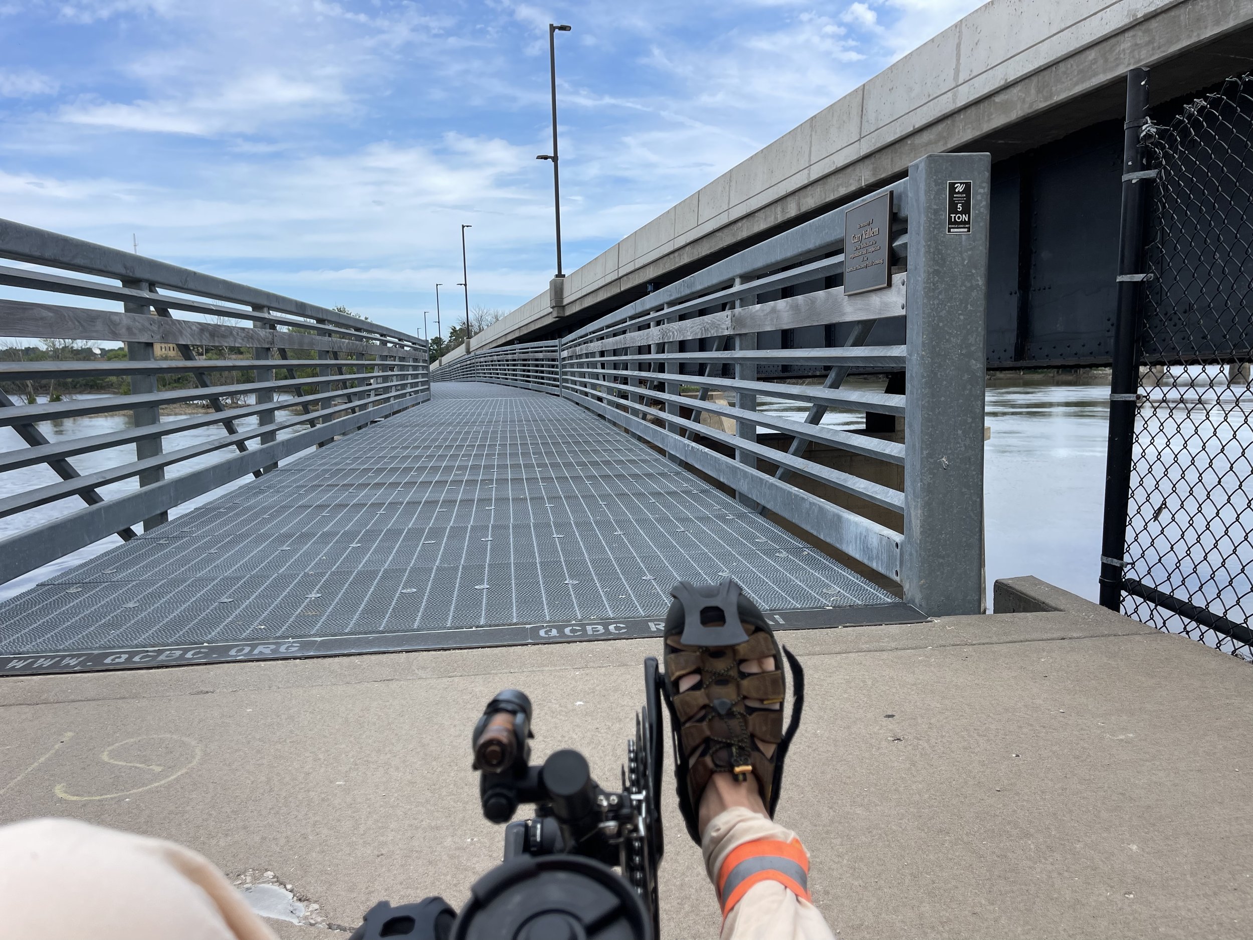
Getting across to Iowa via trike is a two step process, at least along the route that I took. First, you have to cross to Arsenal Island, via this bridge, apparently sponsored by the Quad Cities Bicycle Club, which appears to be an active group, with a calendar full of group rides and events.

QCBC Bridgr

Arsenal Island

This bridge gets you on to Arsenal Island itself, which is aptly named:

Rock Island US Army Arsenal

Well, it’s aptly named now, given that it is the largest government owned weapons manufacturing arsenal in the United States.

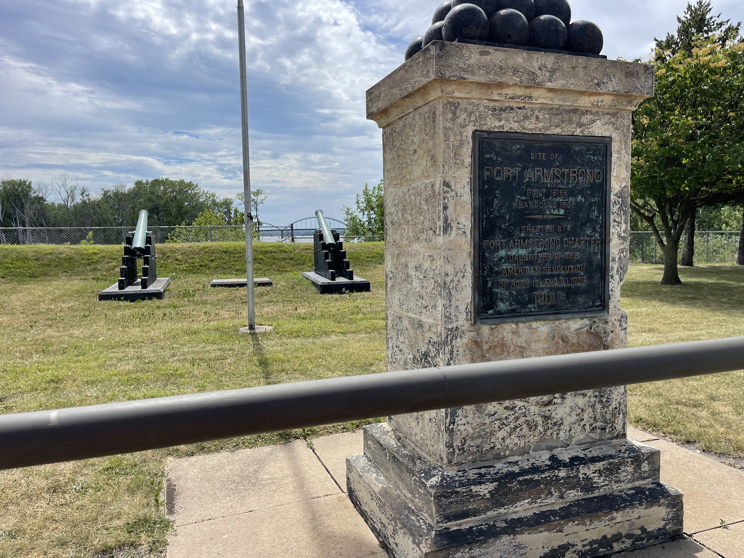
Preceding the current Arsenal was Fort Armstrong, which was established after the War of 1812 as a set of western frontier defenses. There is a marker for the site directly along the path:

Fort Armstrong Site

But despite the current and former military features, the island’s history shows it as former native land, and the army seizure of it involves it as part of the disputed territory resulting in the Black Hawk War. On the island, and it’s occupation but the army, Black Hawk was quoted as saying:

This [island] was the best one on the Mississippi, and had long been the resort of our young people during the summer. It was our garden, like the white people have near their big villages, which supplied us with strawberries, blackberries, gooseberries, plums, apples and nuts of different kinds. Being situated at the foot of the rapids, its waters supplied us with the finest fish. In my early life I spent many happy days on this island. A good spirit had charge of it, which lived in a cave in the rocks immediately under the place where the fort now stands. This guardian spirit has often been seen by our people. It was white, with large wings like a swan's, but ten times larger. We were particular not to make much noise in that part of the island which it inhabited, for fear of disturbing it. But the noise at the fort has since driven it away, and no doubt a bad spirit has taken its place. - Black Hawk

Realizing that much of this occurred around and during the presidency of Andrew Jackson, he of the Trail of Tears, makes it all unsurprising, but no less sad. Incidentally, fans of US History will be well served by following that link for the Black Hawk War. It’s a long article, but the war, which I suspect is little known outside of northern Illinois, involves a vast array of names that you’ll recognize from later history, including such minor historical figures as Abraham Lincoln and Jefferson Davis, among others.


Arsenal Bridge/Government Bridge

Not far past the Fort Armstrong site you will come to the bridge crossing from Arsenal Island into Iowa. This bridge is known both as the Arsenal Bridge and - perhaps more widely as Government Bridge.

Government Bridge

It’s an impressive steel structure, over 100 years old, serving multiple paths, with rail at the top, automotive traffic below, and foot and cycling to the side. This is the crossing that Rails to Trails originally identified as its crossing point between the Illinois and Iowa sections of the Great American Rail Trail. The current map has been updated, however, to include both the Government Bridge and the new I-74 bridge discussed above, since that also has a pedestrian and cycling bridge on it.

Even though it’s not the only way to cross any more, it’s still an interesting way to get there, and this history buff prefers the 100+ year-old option:

Davenport

Davenport is one half of the Iowa pair of the Quad Cities (Moline and Rock Island are the two on the Illinois side. Wikipedia also describes East Moline as part of the Quad Cities, but wouldn't it then be the Quint Cities? But I digress…).

I had originally planned to stay for only a few short minutes on the Iowa side and then turn around, with a goal of writing about how the air on that side of the Mississippi just seemed heavier, more oppressive than the air in my fine state of Illinois. I have family who live over there in Iowa, and this is a fond refrain that I will use with them if the opportunity presents. It’s never not funny (to me).

But the reality was that I had planned to have my lunch somewhere along the Mississippi River, and while Google Maps had suggested that there were several restaurants available, looking for them while riding found that they mostly seemed to be a block or two away from the river as opposed to begin right along it like I’d hoped. It’s absolutely possible that I’d missed something along the way, but since I was pausing on the Iowa side I thought I’d take a gander at downtown Davenport on the map to see what was available, and it appeared there were multiple options within a short distance of the trail.

I settled on The Barrel House:

Val at the Barrel House

The menu was exactly what I was looking for, burgers and beer being prominent components. And as a bonus, there was outdoor seating, which I always prefer in general in the summer, but it was especially nice because I could keep my ride in sight while I quaffed:

Bent River Wheat with Val in the distance

I enjoyed their variation on a blue cheeseburger, along with a Bent River Island Time Wheat, an excellent local beer I’d never had before. In fact, there may have been two of those cross my table. And, again trying to learn from day one, I sat back and relaxed for a while.

So, for better or worse, Davenport was just too pleasant and accommodating for me to make my joke about the oppressive nature of being in Iowa. But don’t let the Iowa members of the fam know, okay?

Heading Back

I’d stopped for lunch around two in the afternoon, and while I was taking my time, I wanted to be sure to get back on the trail early enough to be ahead of the area’s Friday rush hour before I got back onto the road portion of the return trip.

I succeeded in this, but only just. I did find the direct route off of the Great River Trail that I had missed on the way in, which helped. Still, things were definitely getting busier as I re-approached I-92, and I found myself spending a lot more time than usual (which is saying something) watching my mirrors. Fortunately, it was uneventful.

I did stop at a Casey’s in Carbon Cliff on the way back to buy a couple of bottles of water. Again, trying to learn from before, I wanted to be sure I had enough water for both the return trip to Geneseo Campground and I planned to fill them to bolster my supply for the trip home the following day.

And, once I got there, it was nice to be on the trail itself again:

Back on the trail

Once I was back at the campground, it was all a simple case of making up some food with the JetBoil - Chicken Teriyaki and Rice this time, which turned out to be the only mediocre meal of the bunch, with the chicken coming out just a bit dry. But I suppose it’s possible that I didn’t use enough water.

The Vintage RV folks appeared to have hired either a band or a DJ, which played a little past the 10pm quiet time, though that seemed reasonable enough for a Friday night. I gave thought to going up to listen for a bit, but, well, I didn’t want to. I’m a solitary person by nature, and when I spend time alone - as I am on this trip - instead of becoming satiated I tend to get progressively better at being alone. So instead I fired up the iPad, where I’d downloaded Doctor Strange and The Multiverse of Madness ahead of the trip for just such an occasion, popped in my AirPods, and packed it in for the night.

Hennepin Canal Trip - Working Thru the Checklist by Erin Wade

I’m now a little less than two weeks out from my start-to-finish and back trip along the Hennepin Canal Trail. Given that, I’m making preparations and reviewing my checklist to make sure I have everything put together.

Making a list, checking it twice…

In many ways this has been an adventure in discovering the world of products designed for lightweight, outdoors travel. As a younger person I went camping periodically and I still have a fair amount of equipment from that era. However, pretty much all of it assumed that one was going to be piloting some sort of automobile either directly up to the campsite, or at least very close to it. I love my old green Coleman camp stove, but lightweight it is not.

Several weeks ago I ordered a lightweight tent and air mattress, and I already had a sleeping bag that I’d purchased for car camping at the Hilly Hundred last year. So I’m good in that department, but I still need to get practice setting it up and taking it down so I’m not learning that in the moment. I’ll plan to do that over the next few evenings.

When discussing what to do about food with My Lovely Wife she first suggested looking into whether MRE’s are something that can be ordered from Amazon.

It turns out that they can, but that search also opened the door to freeze-dried meals designed for backpacking (and hence, suitable for trikepacking). There are a variety of these available, and with no experience with them I decided to order one and give it a try. I went with Peak Refuel - they have good reviews on Amazon - and specifically tried the breakfast scramble. It was easy to make - just add the specified amount of boiling water, stir, and wait - and surprisingly good. I was a little afraid it would suffer from the Turkey Bacon Problem, but I was happy to be proven wrong. I suppose this is due, in part, to the fact that it is made of the real, expected ingredients.

Obviously I am not just going to eat breakfast skillet for every meal, so I ordered up a batch of these to cover breakfast and supper:

Future fuel

It would have been rather costly to try each of these in advance, so I picked some things I was pretty sure I would like with the hope that the breakfast skillet meal is a fair representation of the overall product. We shall see.

For lunch on day one and three I’m planning on bringing along granola bars and/or trail mix. This has been my strategy for longer day rides and it’s worked well for me. Lunch on day two will be at a restaurant in the Quad Cities. I haven’t picked one yet, but I’m planning on eating somewhere along the Mississippi. And I may just leave that up to spontaneity and serendipity. Tho, honestly, that is not my way, so I may break down and plan something…

To prepare those freeze dried meals, and more importantly, to be able to make coffee on my ride, I also need to be able to heat up some water. As mentioned before, it was clear my old Coleman camp stove was not going to do. There are a number of single-burner camp stoves that incorporate the fuel tank into the stand. I landed on the Jetboil Flash.

Jetboil Flash

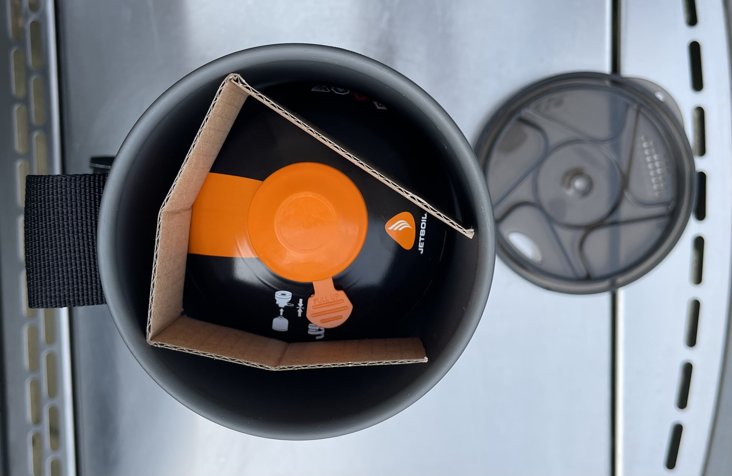
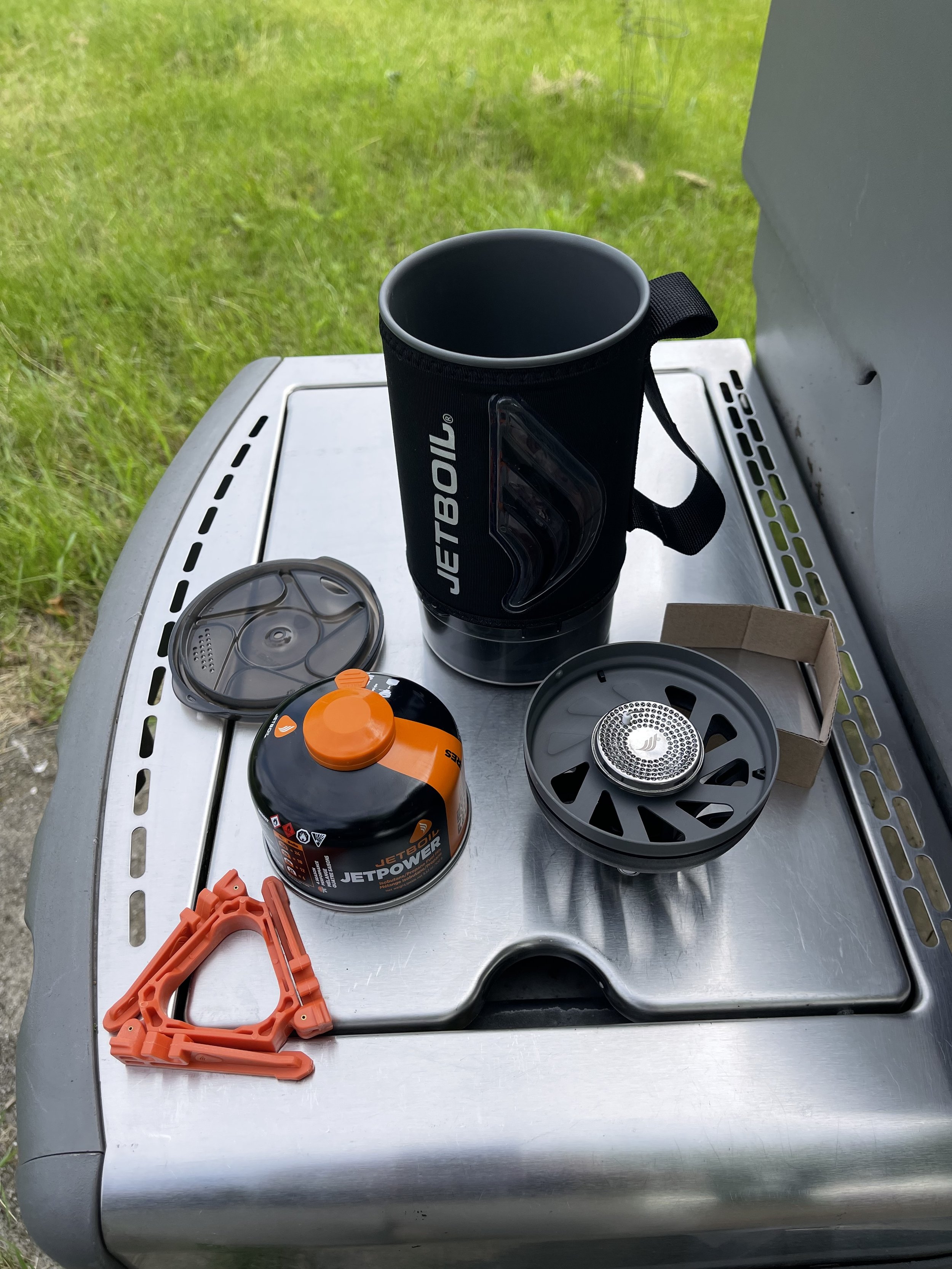
There’s a lot to like about this product for trikepacking. In addition to being lightweight, it’s relatively small, and entirely self-contained when it is packed. Literally everything you need fits inside it:

Packed

Unpacked

As the name implies, it heats water to boiling very quickly. I should be able to get my breakfast started and then heat up a second pot for coffee well before the food is ready to eat. It has a couple of other neat features as well. The lid is also a drink cover - you could make soup in it, for example, and simply drink it out of the Jetboil pot. The protective plastic cover on the bottom is also a measuring cup and can be used as a bowl. And there is also this:

Heat Indicator

The side changes color as it heats up as a temperature indicator. It’s clearly a thoughtful design, and it seems sturdy. We’ll see how it stands up on the ride, but I’m optimistic based on my experience with it so far.

I do have a handful of remaining items to obtain. This morning I ordered a first aid kit and a fresh batch of tube patches. Obviously I hope not to need either, but I can just about guarantee that I will need them if I don’t have them.

I’ve debated about ordering a solar panel for charging battery packs. It’s on my list, but I have three or four battery packs I can bring along, and my camping site is supposed to have electric access, so it may not be necessary.

I also need to sort out how much water to carry. I should be able to get water at the campsite in the afternoon/evening of day one and two, and there will be spots to buy it during the day on day two. That would suggest I’ll be fine if I bring along enough to cover the ride in on day one, and fill those bottles again for the ride out on day three.

I am getting a little concerned that my side cargo bags - the Radical Design Banana Racers that I ordered - may not come in on time for the ride. They were supposed to come in the last week of May, but when I checked on it earlier this week I was told that it was still in transit from The Netherlands. If they are not in by the end of this week I’ll have to pivot - either use the backpacks stacked up like I tried earlier, or maybe break down and get the bags in a non-orange color (the horror!).

And finally, this weekend and next I’ll be working in extended rides - in the 40-50 mile range - to build up conditioning a bit for the trip. And now it’s time to check that item off my list for today…